Location of Capernaum, Israel: Map, Access, and Sites
Location of Capernaum, Israel: Map, Access, and Sites
Capernaum is located on the northwestern shore of the Sea of Galilee in northern Israel. The ancient town is preserved at Kfar Nahum National Park, near the modern communities of Tabgha and Ginosar and approximately northeast of Tiberias.
The site is commonly identified as Kfar Nahum, the Hebrew name for Capernaum. Visitors come to see the ruins of the ancient lakeside settlement, including a large limestone synagogue, a traditional site associated with Peter’s house, and remains of Byzantine Christian buildings.
Capernaum stands along the northern edge of the Sea of Galilee, also called Lake Kinneret or Lake Tiberias. It is in the Galilee region, east of the Mediterranean coast and north of Tiberias. The archaeological park sits close to the shoreline, although the water level and the appearance of the shore can change over time.
On a map of Israel, look for the Sea of Galilee in the country’s north. Capernaum is on the lake’s northwest side, while Tiberias is on the western shore farther south. The town of Magdala lies southwest along the lake, and the sites of Tabgha and the Mount of Beatitudes are nearby to the west and northwest.
The ruins are not in the modern city of Capernaum because there is no large modern city by that name. Instead, the historic location is an archaeological and religious site within a protected park. Road signs may use either Capernaum or Kfar Nahum, so recognizing both names makes driving easier.
Map tip: Search for “Capernaum National Park” or “Kfar Nahum” rather than simply searching for the biblical name. The archaeological site is on the lake’s northwestern shore, near Route 87 and the road connecting the Galilee sites.
How Capernaum fits into the northern Sea of Galilee area
Capernaum is part of a compact group of historic sites around the northwestern Sea of Galilee. Several can be visited on the same outing, but their entrances and walking conditions differ. The distances below are approximate and can vary depending on the route, entrance, and starting point.
Tiberias: the main resort and transportation center on the western side of the lake, south of Capernaum.
Tabgha: a short distance west of Capernaum, known for several Christian churches and pilgrimage traditions.
Mount of Beatitudes: a hillside site northwest of Capernaum with broad views over the lake.
Korazim: an archaeological site north of the lake, associated with the ancient towns mentioned alongside Capernaum in the Gospels.
Magdala: an archaeological and religious site farther south on the western shore.
Jordan River outlet: the northern area where the Jordan River flows out of the Sea of Galilee, close to several nature and pilgrimage destinations.
These locations are near one another geographically, but the area is not designed as one continuous pedestrian route for every visitor. Most people travel between them by private vehicle, organized tour, taxi, or hired driver. Walking between sites may involve exposed roads, uneven shoulders, heat, and longer distances than a map seems to suggest.
How to reach Capernaum by car
Driving is usually the simplest way to visit Capernaum and the neighboring sites. From Tiberias, travelers generally follow roads north and then west or northeast toward the northern shore, using signs for Capernaum, Kfar Nahum, Tabgha, and the Mount of Beatitudes. From northern Israel, routes approach the lake through the Galilee and connect with the roads around the Sea of Galilee.
Road names and navigation instructions can vary as mapping services update their routes. Use the destination Kfar Nahum National Park and confirm that the route ends at the archaeological park, not at a similarly named religious building or a point on the lakeshore.
Choose the exact destination: enter Capernaum National Park or Kfar Nahum in your navigation app.
Check the road approach: identify whether the route uses Route 90, Route 87, or local access roads from the western shore.
Allow extra time: roads around the lake can be slower than their distance suggests, especially during holidays and pilgrimage seasons.
Park in the designated area: follow signs and do not leave a vehicle on a narrow shoulder or in front of access gates.
Walk from the entrance: the principal ruins are reached on foot, and the site includes sun-exposed paths and uneven surfaces.
If you are renting a car, check the vehicle’s navigation system against a current map before leaving Tiberias or another base. Mobile reception may be inconsistent in parts of the region. Carry the address in both English and Hebrew, since Kfar Nahum can help when asking for directions.
Visiting Capernaum from Tiberias and nearby bases
Tiberias is the most familiar base for visitors exploring the Sea of Galilee. It has hotels, restaurants, shops, and services, while Capernaum is a quieter archaeological location with limited facilities immediately around the ruins. A trip from Tiberias can be combined with Tabgha, the Mount of Beatitudes, and other northern lake attractions.
Visitors staying in Safed, Nazareth, Haifa, or Jerusalem can also reach Capernaum by car or guided excursion, but a day trip from farther cities requires more planning. Public transportation connections may require transfers and may not place you directly at the archaeological entrance. Timetables, seasonal service, and Sabbath or holiday schedules should be checked before traveling.
Organized tours often approach the site as part of a Christian pilgrimage itinerary. This can be convenient if you want transportation and historical commentary, but the time at each stop may be fixed. A private car gives you more flexibility for walking, photography, and visiting nearby sites at a quieter pace.
What you will find at the Capernaum archaeological site
The settlement visible today represents several periods of occupation, with the most recognizable ruins associated with the ancient Jewish town and later Christian presence. The site is arranged around paths that lead through residential remains, religious buildings, and structures close to the former shoreline.
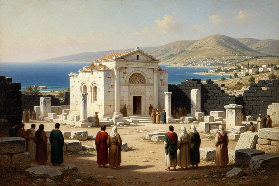
The most prominent landmark is the white limestone synagogue. Its finely carved architectural elements stand out against the darker basalt used in many local buildings. The synagogue visible today belongs to a later period than the time of Jesus, but it was built over or near an earlier synagogue tradition, making the location significant for understanding the development of the town.
Nearby are the remains traditionally connected with Peter’s house. A modern church has been built above the excavated area, and its unusual elevated design allows visitors to look down toward the archaeological remains. The identification reflects longstanding Christian tradition and the site’s relationship to Gospel accounts, while the surviving structures also provide evidence about domestic life and early Christian worship.
Other remains include streets, courtyards, houses, and public or religious structures made from local basalt. These stones help visitors picture the settlement as a lakeside village rather than a monumental city. The ruins also show how the town changed as religious communities and visitors continued to use the area.
Why Capernaum is important in the New Testament
Capernaum is strongly associated with the ministry of Jesus in Galilee. The Gospel accounts describe it as a place where Jesus taught and performed acts of healing, and it is often presented as a central base for activity around the Sea of Galilee. References appear in passages including Matthew 4, Mark 1, Luke 4, and John 6.
The accounts connect Capernaum with several disciples, including Simon Peter, Andrew, James, and John. They also describe teaching in a synagogue and events involving people who came to the town for healing or instruction. These references give Capernaum an important place in Christian pilgrimage, even though the archaeological remains come from multiple periods rather than from one single moment.
Capernaum is also mentioned alongside Chorazin and Bethsaida in the Gospel tradition. Those places form part of the northern Sea of Galilee landscape that helps visitors understand the geography of Jesus’ Galilean ministry. Seeing the lake, hills, and village sites together provides context that is difficult to gain from a map alone.
Matthew 4:13 describes Capernaum as the place where Jesus lived or made his base after leaving Nazareth; the passage presents the town as a significant setting in his Galilean ministry.
The biblical references should not be confused with a claim that every visible wall belongs to the first century. Archaeology separates building phases and uses material evidence to identify different periods. The site’s importance comes from the combination of textual tradition, archaeological remains, and geographic setting.
How the ancient town’s location shaped daily life
Capernaum’s position beside the Sea of Galilee helped make it a practical settlement. The lake supported fishing, transport, and access to neighboring communities. The town also stood near routes crossing the Galilee, linking the lakeshore with inland areas.
Fishing was central to the local economy, and the nearby water shaped food production, work patterns, and travel. The settlement’s basalt buildings reflect the volcanic geology of the region. Limestone was also used, particularly in the synagogue, creating a visible contrast between ordinary houses and more elaborate public architecture.
The lakeshore location also explains why the site can feel different from the surrounding hills. Capernaum is relatively low compared with the nearby uplands, and the surrounding landscape opens toward the water. Weather can shift quickly around the lake, with strong sun, wind, and seasonal changes affecting comfort on the exposed paths.
What to know about the Capernaum synagogue
The synagogue is the site’s most recognizable structure and one of the best-known ancient buildings around the Sea of Galilee. Its pale stone walls and carved details include decorative motifs that are more elaborate than those found in the surrounding residential remains.
Visitors sometimes assume that the visible synagogue is exactly the building used during Jesus’ lifetime. The chronology is more complicated. The standing structure is generally dated to a later period, while archaeological evidence indicates an earlier synagogue existed in the area. The later building therefore helps identify the importance of the location, but it should not be described as an unchanged first-century building.
Look closely at the columns, doorways, carved panels, and foundation stones. These features show the skill and resources invested in the synagogue. They also make the site useful for understanding Jewish communal architecture in the ancient Galilee.
Because the synagogue remains are religiously and historically significant, follow posted rules about access, photography, and behavior. Some parts may be restricted, especially during religious observances or conservation work.
What to know about Peter’s house and the modern church
Tradition identifies one of the residential areas near the synagogue as the house of Peter. Excavations revealed a domestic structure that was later treated differently from neighboring homes. Changes in the floor, walls, and use of the space have been interpreted as evidence that the area became associated with Christian worship.
A modern church now stands above the remains. Its raised, circular form is designed to protect the archaeological area and give visitors a view of the structures below. The building is also an active place of Christian pilgrimage, so visitors should expect moments of prayer and quiet observance.
The traditional identification is meaningful to many pilgrims, but the precise identity of an ancient house cannot be proven in the same way as a dated inscription. The clearest evidence concerns the building’s structure and later use. This distinction allows visitors to appreciate both the religious tradition and the archaeological limits of the evidence.
When to visit Capernaum
The best time of day depends on your priorities. Early morning usually brings cooler temperatures, softer light, and fewer large groups. Late afternoon can provide attractive light over the lake, although you should allow enough time before the park and nearby religious sites close.
Spring and fall are often comfortable seasons for walking, but conditions vary from year to year. Summer can be very hot, especially on the open paths near the synagogue and shoreline. Winter may bring cooler weather and occasional rain, so check the forecast before setting out.
Morning: best for cooler walking conditions and a quieter visit.
Midday: convenient for combining the site with nearby attractions, but usually the hottest and brightest period.
Late afternoon: useful for lakeside views and photography, provided you arrive while facilities remain open.
Religious holidays: may bring larger crowds, special services, traffic, or changes in access.
Opening hours, entrance fees, and access arrangements can change. Check the current information from the relevant Israeli parks authority or local visitor service before traveling, particularly if you are planning around a tight itinerary.
What to bring for a visit to Capernaum
The archaeological park is not a shopping district, so prepare before leaving your hotel or tour vehicle. Bring water, sun protection, comfortable footwear, and a small bag for personal items. A hat and lightweight clothing can make a noticeable difference during warm weather.
Water: carry enough for the walk, especially in hot months.
Walking shoes: choose shoes with a stable sole for uneven stone and packed ground.
Sun protection: bring a hat, sunscreen, and sunglasses because shade is limited in several areas.
Modest clothing: religious buildings may expect shoulders and knees to be covered.
Cash or payment method: useful for parking, refreshments, or nearby services, depending on current arrangements.
Current map: keep an offline map or written destination name in case mobile service is weak.
Families with small children should consider a carrier rather than relying entirely on a stroller. Some paths are manageable, but ancient stone surfaces and steps can make rolling equipment difficult. Visitors with mobility limitations should contact the site ahead of time to ask about accessible routes and current conditions.
How long to spend at Capernaum
Many visitors spend 45 minutes to 90 minutes at the main archaeological area, depending on their interest in history, prayer, photography, and the interpretation displays. A brief stop is enough to see the synagogue and church, while a slower visit allows time to examine the residential remains and read the site information.
Plan additional time if you are visiting the neighboring sites of Tabgha, the Mount of Beatitudes, or Korazim. Driving, parking, walking between entrances, and waiting for a group can make a northern Sea of Galilee itinerary longer than expected.
A practical schedule might begin with Capernaum in the morning, continue to nearby religious and archaeological sites, and finish with time beside the lake. Keep the itinerary flexible during busy seasons, since tour buses and local traffic can affect parking and departure times.
How Capernaum differs from other Sea of Galilee sites
Capernaum is often confused with nearby Bethsaida, Chorazin, and Tabgha because all are connected with the Galilee and the Gospel narratives. They are separate places with different archaeological remains and access points.
Capernaum: a lakeside settlement with the famous synagogue ruins and the traditional site of Peter’s house.
Tabgha: a nearby Christian pilgrimage area with churches and traditions connected to events in the Gospel accounts.
Chorazin: an ancient hilltop settlement north of the Sea of Galilee with basalt ruins and a synagogue.
Bethsaida: a separate archaeological site associated with the northeastern part of the lake region.
Mount of Beatitudes: a hillside pilgrimage site rather than an ancient town preserved in the same way as Capernaum.
Knowing these distinctions prevents a common planning mistake: assuming that every northern Sea of Galilee attraction is located at one entrance. Use each site’s name when navigating and allow time to move between them.
Practical etiquette at Capernaum
Capernaum is both an archaeological park and a place of worship. Wear respectful clothing, keep voices low inside churches, and avoid climbing on walls or touching fragile carved stones. Follow barriers even when a ruin appears easy to reach.
Photography is generally part of the visitor experience, but tripods, commercial photography, and photography during services may require permission or restraint. Do not use drones unless you have confirmed that they are permitted under current Israeli regulations and site rules.
Respecting the location also means leaving stones, pottery fragments, plants, and other objects where they are. Even a small fragment can be valuable evidence for archaeologists and may be protected by law.
Using Capernaum’s location to plan a wider itinerary
The site works well as one stop on a circuit around the Sea of Galilee. Start by identifying your base, then group attractions by shoreline and driving direction rather than trying to cross the lake repeatedly. This reduces backtracking and leaves more time for the places you most want to see.
For a history-focused day, combine Capernaum with Korazim and another archaeological site. For a Christian pilgrimage day, add Tabgha and the Mount of Beatitudes. For scenery and rest, leave time for viewpoints, lakeside walks, or a meal in Tiberias or another nearby community.
Remember that the biblical landscape includes hills, water, villages, roads, and changing weather—not only ruins. A few minutes looking across the Sea of Galilee can help explain why Capernaum became a natural center for fishing, teaching, and travel in ancient Galilee.
Planning reminder: Capernaum is easy to identify geographically but not always easy to visit spontaneously. Confirm opening conditions, modest dress expectations, transportation, and the day’s heat before setting out.
Why the exact location matters to visitors
Knowing that Capernaum sits on the northwest shore of the Sea of Galilee gives the site meaning beyond a pin on a map. The location explains its connection with fishing communities, nearby villages, inland roads, and the Gospel stories set around the lake.
It also helps you interpret what you see. The white synagogue, basalt houses, church above the traditional home of Peter, and open water are not isolated attractions. Together they represent a settlement shaped by Jewish life, regional trade, fishing, Roman-era development, and later Christian pilgrimage.
For the clearest visit, search for Kfar Nahum National Park, approach from the western or northern Sea of Galilee roads, and set aside time for both the archaeological remains and the landscape around them. That combination provides the most useful sense of where Capernaum is and why its location has mattered for centuries.
Frequently asked questions
Is Capernaum in Israel or Palestine?
The ancient site of Capernaum is in northern Israel, on the northwestern shore of the Sea of Galilee. It is administered as an Israeli national park and is commonly identified by its Hebrew name, Kfar Nahum. Travelers should use current Israeli park information for opening conditions, admission details, and directions.
How far is Capernaum from Tiberias?
Capernaum is north of Tiberias on the western side of the Sea of Galilee. The exact travel distance depends on the route and starting point, but it is commonly visited as a day trip from Tiberias. Allow extra time for traffic, parking, and stops at Tabgha or other nearby attractions.
Can you visit Capernaum without a car?
Yes, but public transportation may involve transfers and may not stop directly at the archaeological entrance. Guided tours, taxis, and hired drivers are often more practical than relying on buses alone. Check current routes and schedules before traveling, especially on weekends, holidays, or religious observances.
Are Capernaum and Kfar Nahum the same place?
Yes. Capernaum is the English form of the ancient town’s name, while Kfar Nahum is the Hebrew name used for the archaeological site and national park. Maps, road signs, and tourism information may use either name, so searching for both can make navigation more reliable.









Leave a Reply