River of Egypt: Meaning, location, and biblical context
River of Egypt: Meaning, location, and biblical context
The River of Egypt usually refers to Wadi el-Arish, a seasonal watercourse in the northern Sinai rather than the main Nile River.
The phrase appears in several biblical passages describing the southern or southwestern limit of Canaan and the extent of Israel’s territory. Its meaning matters because biblical geography often uses familiar natural features to describe borders, while modern readers may assume that every reference to “Egypt” points directly to the Nile.
“River of Egypt” is an English rendering of Hebrew expressions used in the Old Testament. The wording does not always function like the name of a single, permanently flowing river. In some passages, it describes a watercourse, stream valley, or seasonal channel associated with Egypt’s northeastern frontier.
The Hebrew Bible uses more than one expression connected with this boundary. The word nahar commonly refers to a river, while nachal can describe a wadi or ravine that carries water during rainy seasons. That distinction is useful, but it does not settle every question because biblical terms can be used flexibly and translations differ.
Several passages connect the River of Egypt with the territorial boundary between Canaan and Egypt. Genesis 15:18 describes God’s covenant with Abram by naming territory that extends from the river of Egypt to the Euphrates. Exodus 23:31 similarly describes the land’s limits, placing the River of Egypt at one end of the promised territory.
Other passages use the phrase in descriptions of tribal or national boundaries. Numbers 34:5 places the western or southwestern boundary of the land near the ascent of Akrabbim and the River of Egypt. Joshua 15:4 gives a related boundary description for Judah, while 1 Kings 8:65 refers to a region extending from the entrance of Hamath to the Brook of Egypt.
Core distinction: “River of Egypt” is a biblical geographic term, not automatically another name for the Nile. In many boundary passages, the most likely location is a seasonal wadi in the northern Sinai.
The phrase should also be distinguished from ordinary references to the land of Egypt. Biblical writers can mention Egypt as a kingdom, a place of refuge, or a source of military power without referring to its boundary stream. The surrounding passage determines whether the wording is geographical, political, historical, or symbolic.
Why Wadi el-Arish is the leading identification
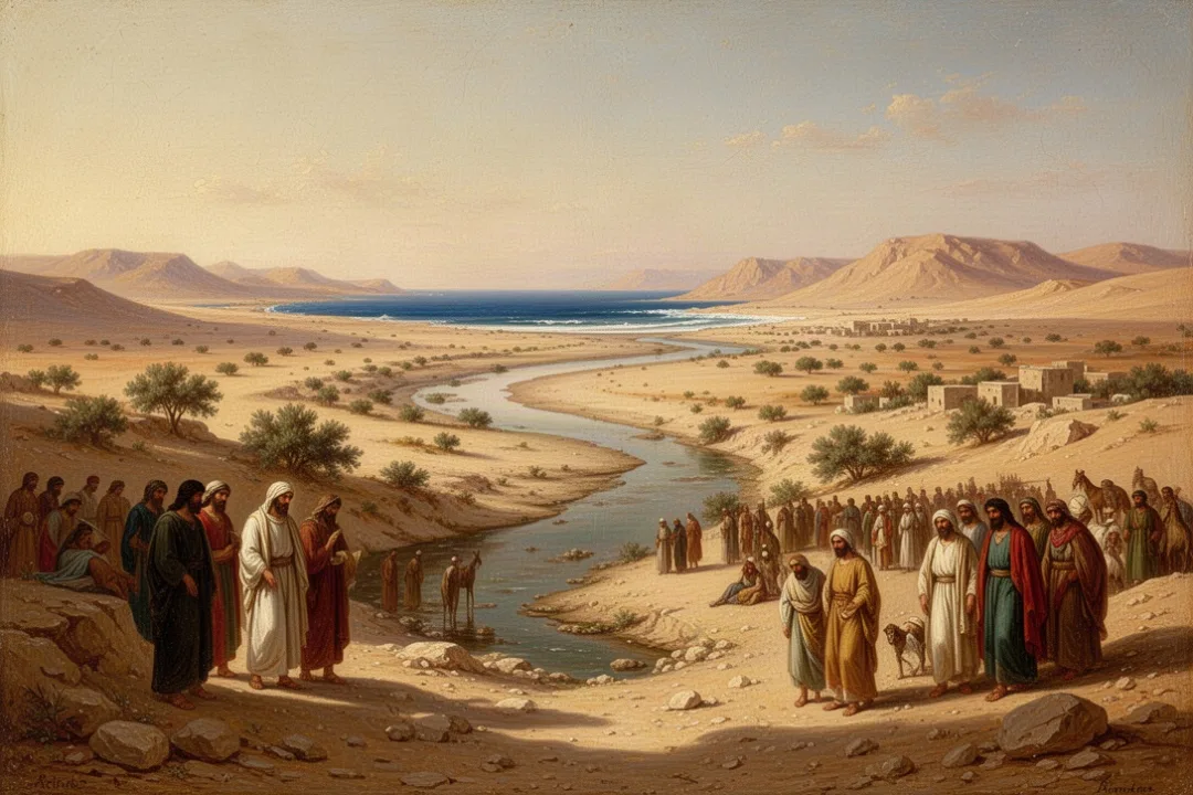
Wadi el-Arish is a broad drainage channel that runs through the northern Sinai toward the Mediterranean coast. It is not comparable to the Nile in size or year-round flow, but heavy seasonal rain can send water through the wadi. Its location makes it a natural candidate for a boundary described as lying between Egypt and the land farther east.
The wadi reaches the Mediterranean near the modern city of Al-Arish, roughly in the northeastern part of the Sinai Peninsula. In ancient and modern geography, this area forms a practical corridor between Egypt and the southern Levant. A traveler moving along the coastal route would encounter a recognizable landscape feature before entering the regions associated with Canaan.
Support for this identification comes from several features of the biblical evidence:
Its position fits a southwestern boundary: Wadi el-Arish lies east of the Nile Delta and southwest of the main Canaanite heartland.
It is a substantial natural feature: A large seasonal drainage system would be suitable for describing a territorial limit.
It belongs to the Egypt-Sinai transition zone: The wadi sits in the region where Egyptian influence and Levantine geography meet.
It matches the “brook” wording in some translations: A wadi can be called a brook, stream, or river depending on translation choices.
Wadi el-Arish is sometimes called the Brook of Egypt in English Bibles. “Brook” can sound insignificant to modern readers, but it often reflects the Hebrew concept of a channel that may be dry for much of the year and active after storms. A seasonal watercourse can still serve as a visible regional boundary.
The ancient landscape was not described with modern surveying methods. People identified places through coastlines, mountain passes, roads, springs, wadis, and major rivers. A watercourse did not need to flow continuously to be geographically useful. Its valley, mouth, and drainage basin could make it an obvious landmark.
The location also helps explain why the term is linked with Egypt even though Wadi el-Arish is in the Sinai. The word “Egypt” may identify the political or geographic region on one side of the boundary, while the channel itself lies in a frontier zone. Ancient borders were often zones of transition rather than sharply marked lines.
Why some readers identify it with the Nile
The Nile River remains an important alternative in some interpretations, especially when readers focus on passages that describe an expansive ideal territory. The Nile was the dominant river of Egypt and one of the best-known geographic features in the ancient Near East. If a text says “the river of Egypt,” a reader may naturally understand it as the Nile unless the context points elsewhere.
This interpretation has some apparent support. The Nile’s eastern branch or the eastern edge of the Nile Delta could have represented Egypt’s boundary in certain historical periods. The Delta was a changing region of waterways, marshes, and channels, so an ancient writer might refer to a particular eastern branch rather than the entire river system.
However, identifying every reference with the Nile creates geographical difficulties. The Nile lies considerably west of the traditional land of Canaan. A boundary from the Nile to the Euphrates would describe a much larger territory than the area usually associated with Israel and Judah in ordinary historical descriptions. The wording may describe an ideal or promised extent, but that possibility should not be confused with the more local boundary passages.
There is also a linguistic issue. Some biblical passages use a term translated as “brook of Egypt”, which fits a wadi more naturally than the great Nile. Other passages use language that can be translated as “river of Egypt,” leaving more room for debate. Translation differences are one reason maps and commentaries do not always label the location in exactly the same way.
The most careful approach is to consider each passage on its own:
Check the Hebrew term or translation tradition. “River” and “brook” may reflect different underlying words.
Read the surrounding boundary description. Nearby place names can indicate whether the text is discussing Judah, Canaan, Egypt, or a broad ideal territory.
Compare the scale of the passage. A tribal boundary may point to a local stream, while a sweeping covenant description may use broader geographic language.
Allow for historical variation. Names and political boundaries could refer to different features in different periods.
Wadi el-Arish is therefore the standard identification for many specific biblical boundary references, but the Nile question should not be dismissed as mere confusion. It reflects a real interpretive issue involving language, context, ancient geography, and the changing shape of Egypt’s eastern frontier.
What the main biblical passages describe
Genesis 15:18 and the covenant boundary
Genesis 15:18 records a covenant in which the land promised to Abram’s descendants is described as extending from the river of Egypt to the Euphrates. The verse is notable because it gives a broad east-west span rather than a detailed survey. It presents the two rivers as outer markers of an expansive promised land.
The passage does not provide enough information by itself to prove whether the western marker is Wadi el-Arish or the Nile. Its purpose is theological as well as geographical: it emphasizes the scope of the divine promise. Interpreters therefore ask both what location the phrase denotes and how the larger covenant description functions within Genesis.
Exodus 23:31 and the land’s limits
Exodus 23:31 describes the land in relation to the Red Sea, the Philistine coast, and the wilderness, then names the River of Egypt and the Euphrates. The wording places the river within a broad account of territorial reach. It may reflect an idealized description of the sphere in which Israel is promised security and authority.
Because this passage lists several major geographic regions, it is often discussed alongside Genesis 15:18. Still, the same expression can have a more precise meaning in other books. A broad theological boundary and a local administrative boundary need not use the term in exactly the same way.
Numbers 34:5 and Joshua 15:4
Numbers 34 describes the boundaries of the land assigned to the Israelites. The southern boundary includes a route from the wilderness of Zin toward the border of Edom, then turns toward the ascent of Akrabbim and continues to the River of Egypt. This kind of boundary description is one reason many scholars favor Wadi el-Arish rather than the Nile.
Joshua 15 gives a related southern boundary for Judah. It names locations in the Negev and then reaches the Brook of Egypt before ending at the Mediterranean Sea. The sequence sounds like a regional itinerary along the southern edge of Judah, making a nearby Sinai watercourse more plausible than a river hundreds of miles farther west.
Isaiah 27:12 and a later prophetic image
Isaiah 27:12 mentions the River of Egypt in a prophetic passage about gathering and separating people. The imagery moves across a wide region, from the Euphrates toward Egypt. Here the river serves as a geographical marker within a message of restoration, not simply as a line on a political map.
The prophetic context warns against treating the phrase as if every use had the same technical function. Isaiah may draw on familiar boundary language while using it to describe the reach of God’s gathering work. The geographic reference remains meaningful, but the passage has a symbolic and theological dimension as well.
How the location fits ancient travel and political geography
The northern Sinai was a crucial corridor between Egypt and the Levant. Routes along the Mediterranean coast connected the Nile Delta with Canaan and continued toward Syria and Mesopotamia. Armies, merchants, messengers, and migrants used this region, although travel conditions depended on water, season, security, and political control.
A boundary near Wadi el-Arish would have been practical because it marked a transition between ecological and political zones. West of the wadi lay areas more directly associated with Egypt. East of it lay the desert margins and the settled lands of the southern Levant. The boundary was not necessarily an empty line; it could include movement, trade, grazing, and contested authority.
Egyptian power did not always stop at one permanent frontier. At different times, Egypt exercised influence beyond the Nile Valley and Delta, especially through the Sinai and the coastal road. As a result, the phrase “River of Egypt” may identify a recognized geographic threshold even when the political boundary changed.
Ancient borders also lacked the precision expected from a modern national boundary. A river, ridge, or wadi could mark an approximate edge while the actual zone of control extended farther in either direction. This helps explain why biblical boundary language can sound exact and flexible at the same time.
Reading tip: Do not place a modern political line on an ancient map too quickly. The River of Egypt may describe a landmark, a frontier zone, or the outer limit of a promised territory depending on the passage.
The wadi’s seasonal nature is not a weakness in the identification. In arid regions, people often organize geography around channels that fill after rain. A dry riverbed can remain visually prominent, guide travel, collect runoff, and divide drainage systems even when no water is present.
Modern maps may show Wadi el-Arish as a drainage feature rather than a conventional river. That difference reflects how contemporary geography classifies watercourses, not necessarily how ancient observers understood them. Translation terms such as “river,” “brook,” and “stream” should therefore be read as approximations of an ancient geographic vocabulary.
How to interpret the phrase without overstating certainty
The best interpretation combines textual context, language, topography, and historical geography. No single factor answers every question. A map alone cannot determine what an ancient writer intended, and a translation alone cannot reveal the exact physical feature.
Use these principles when reading the phrase:
Separate identification from application. First ask where the feature was; then ask what the passage means theologically or politically.
Distinguish local and broad contexts. A boundary for Judah may point to Wadi el-Arish even if a covenant passage describes a much wider ideal territory.
Compare translations carefully. “River of Egypt” and “Brook of Egypt” may reflect differences in Hebrew wording or translation tradition.
Keep ancient geography in view. A frontier could be a corridor or zone, not a surveyed line.
State uncertainty honestly. Wadi el-Arish is widely favored for several passages, while the Nile remains part of the interpretive discussion.
It is also useful to distinguish the River of Egypt from other biblical waterways. The Shihor, the Nile, the Red Sea, and the Jordan appear in different contexts and should not be treated as interchangeable. Similar English wording can conceal different Hebrew names and different geographic settings.
The River of Egypt does not refer to the Jordan River, which lies much farther east and forms a central feature of the land of Israel. Nor should it be confused with the “sea of the Philistines,” a biblical expression associated with the Mediterranean coast. Each feature contributes to a different part of the biblical landscape.
For readers studying biblical maps, the clearest working explanation is this: in passages describing the southern boundary of Canaan or Judah, the River or Brook of Egypt most likely denotes Wadi el-Arish in northern Sinai. In passages describing the farthest reach of a covenant promise, the wording may be interpreted more broadly, and some readers identify the western marker with the Nile or an eastern Nile branch.
That distinction preserves both the strength of the common identification and the genuine complexity of the evidence. It avoids forcing every occurrence into one rigid definition while still giving you a clear geographic reference point.
Why the River of Egypt still matters for biblical study
The phrase illustrates how biblical geography operates on several levels at once. A place can be a physical landmark, a political frontier, a remembered route, and a symbol of the extent of a divine promise. Reading only one of those levels can make the passage seem simpler than it is.
It also shows why ancient place names require careful handling. A modern reader may expect a river to be permanent, a border to be surveyed, and a country to have stable boundaries. The biblical world often worked with seasonal waterways, shifting powers, regional names, and overlapping territories.
For that reason, Wadi el-Arish is more than a point to locate on a map. It helps explain the relationship between Egypt, Sinai, the Negev, and the southern Levant. It also clarifies why biblical descriptions can speak of a boundary that was geographically recognizable without functioning like an international border today.
When you encounter “River of Egypt” in Scripture, begin with the immediate passage. Ask whether it describes a tribal boundary, a national frontier, a covenant promise, or prophetic imagery. That method leads to the most responsible answer: Wadi el-Arish is the leading identification in many specific contexts, but the exact sense depends on the text and its scale.
Frequently asked questions
Is the River of Egypt the Nile River?
Usually, no. In many biblical boundary passages, the term most likely refers to Wadi el-Arish, a seasonal watercourse in the northern Sinai. Some interpreters connect certain broader covenant passages with the Nile or an eastern Nile branch, so the answer depends on the Hebrew wording and the passage’s geographic scale.
Where is Wadi el-Arish today?
Wadi el-Arish lies in the northern Sinai Peninsula and reaches the Mediterranean near Al-Arish, Egypt. It is a broad seasonal drainage channel rather than a continuously flowing river. The area remains part of the transition zone between Egypt, the Sinai, and the southern Levant.
Which Bible verses mention the River of Egypt?
Important references include Genesis 15:18, Exodus 23:31, Numbers 34:5, Joshua 15:4, Isaiah 27:12, and 1 Kings 8:65. Translations may use “River of Egypt,” “Brook of Egypt,” or similar wording, depending on the underlying Hebrew term and translation tradition.
Why do Bible translations use both “river” and “brook”?
The English terms reflect differences in Hebrew vocabulary and translation choices. One Hebrew word commonly describes a river, while another can refer to a wadi or seasonal streambed. Since a wadi may be dry for long periods but fill after rain, “brook” and “river” both convey part of its geographic meaning.






Leave a Reply