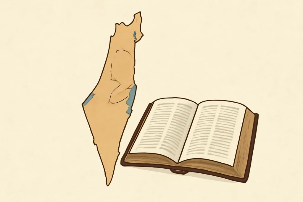
A Bible Israel map or biblical Israel map is not a single, fixed artifact. It is a family of maps that represents the geography, borders, and place-names described in biblical texts across different historical eras. These maps help readers visualize the homeland(s) mentioned in the Scriptural narrative, from the early patriarchal stories through the prophetic period and into the post-exilic era. Because the biblical text covers many centuries and political configurations, a map of biblical Israel often emphasizes the dynamic nature of borders, tribal allocations, and regional geography rather than a single contemporary political outline.
When scholars speak of a bible israel map, they may refer to a:
geographic representation of Canaan/Israel as it appears in the Old Testament
topographic depictions that highlight mountains, valleys, deserts, and water systems
historical atlas showing United Monarchy and Divided Kingdoms phases, plus exilic and post-exilic periods
route maps that trace key journeys, such as migrations, exoduses, and pilgrimage paths
This article uses the term Bible-Israel map to discuss these varieties while acknowledging that modern maps reflect interpretive choices, source texts, and the purposes of scholars, educators, and religious communities. Throughout, we will refer to variations of this term—such as map of biblical Israel, Bible lands map, and Holy Land map—to emphasize semantic breadth and the many ways people imagine the land described in the Bible.
Key regions and lands in biblical times
A typical bible israel map highlights a constellation of regions that recur across biblical narratives. While the exact borders shift from one period to the next, several core areas remain central to the geography of the land.
The core geographic zones
Canaan and the Levant: The broader area often labeled “the land of Canaan” on biblical maps includes coastal plains, central hill country, the Jordan Rift, and the Transjordan plateaus. Geographically, it spans from the Mediterranean coast to the Jordan River valley and beyond.
Transjordan (Moab, Edom, Ammon): The lands east of the Jordan River form a distinct geographic and political sphere in many biblical narratives, sometimes interacting with the western lands through trade and conflict.
The hill country and the Sharon plain: The central highlands of Judah, Ephraim, Manasseh, and Benjamin are often shown as a backbone of the biblical map, with the coastal plain to the west and the Judean foothills nearby.
Jerusalem and the Judean Hills: A focal point in biblical history, the city’s proximity to the Judean hills shapes strategic and religious geography in both narrative and ritual terms.
Megiddo, Beersheba, Dan, Jericho, and Hebron: These sites recur as strategic, political, and religious anchors in the land of Israel map and in prophetic or historical narratives.
Sea of Galilee (Kinneret), Dead Sea, and the Jordan River: The river system and adjacent bodies of water organize much of the hydrology that appears in scriptural geography.
Major topographic features that shape biblical maps
Mountains and hill country—the spine of much of Israel and Judah is a rugged landscape with defensible cities and climate zones that influence settlement patterns.
Deserts and wadis—the Negev in the south and the Negev’s desert corridors, as well as the Wadi Araba region, create natural boundaries and routes for trade and travel.
Rivers and springs—sources such as the Jordan, Yarmuk, and smaller springs (Beit She’an, En Gedi) anchor itineraries and settlements in biblical maps.
Coastal plain and river valleys—these zones support urban growth, agriculture, and imperial road networks referenced in ancient texts.
Historical periods and their map implications
Patriarchal era and the early land of Canaan
The earliest biblical geography centers on the stories of Abraham, Isaac, and Jacob. A bible israel map for this era emphasizes key sites and regions associated with the patriarchs—places like Bethel, Mamre, Hebron, and travel routes through the Negeb and along the coastal plain. Geographic descriptions in Genesis set the stage for later territorial delineations, even as actual political borders were fluid or familial in nature. Maps of this period often focus on routes and settlements rather than formal, fixed borders.
Exodus, wilderness wanderings, and conquest narratives
In the period commonly labeled Exodus and conquest, the Israelites move from enslaved communities in Egypt toward a land allotted by covenant. A Scriptural map of Israel in this era highlights:
major staging points like Rameses, Succoth, and Kadesh-Barnea
the crossing point of the Jordan River and the entry into the Transjordan and western hill country regions
the initial allocations among the twelve tribes in the book of Joshua
Because the narrative emphasizes tribal allotments and theological symbolism, many maps depict territorial outlines that are more conceptual than strictly political. They show how land becomes associated with each tribe and with the logistics of settlement, rather than a tightly controlled state border.
United Monarchy and the expansionist phase
The period commonly termed the United Monarchy under David and Solomon is often depicted on biblical maps as an expansive political entity linking the Jordan River to the Great Sea (the Mediterranean) and stretching toward the Euphrates in some textual traditions. In actual archaeological and textual scholarship, estimates vary; some maps present a broad Hebraic state spanning from the western hills to the eastern territories, while others place tighter boundaries consistent with more conservative readings of biblical texts.
This era also witnesses major city sites such as Jerusalem, Hazor, Megiddo, and Dan rising as administrative and religious centers. A bible israel map from this phase may emphasize road networks—especially the interior King’s Highway and other trade routes—as well as administrative districts or tribal associations within the larger realm.
Divided kingdoms, northern Israel and southern Judah
After the split into Israel (the northern kingdom) and Judah (the southern kingdom), maps of biblical lands frequently show a more complex mosaic. The northern realm often contains cities like Ashkelon, Samaria, Lebanon’s border areas, and a network of border fortresses. The southern kingdom centers around Jerusalem and the Shephelah, with distinct territorial markers west of the Jordan River.
Trans-Jordan remained an important cultural and political zone with Edom, Moab, and Ammon appearing as neighbor polities in many map legends. In addition to political borders, atlases often annotate religious sites—temple locations, altars, and places of sanctuary—that carry narrative weight in prophetic books.
Exilic and post-exilic maps
The late biblical period and the early post-exilic era bring backlines and borders that reflect Babylonian and Persian imperial influence. Maps of this period typically show:
territorial divisions under imperial governors rather than independent tribal lands
cities associated with the return from exile, such as Jerusalem and surrounding towns, and the rebuilding of the wall
the broader province of Yehud under Persian governance
The depictions for this era emphasize resilience, renewal, and religious-memory geography more than large political empires.
Identify the historical period the map intends to represent (Patriarchal, Exodus, United Monarchy, Divided Kingdoms, Exilic/Post-exilic).
Read the legend and any color-coding or symbols that indicate tribal lands, cities, routes, or topography.
Note the scale and the projection used; biblical maps often employ schematic representations that emphasize relative locations rather than precise modern coordinates.
Cross-reference with textual anchors: identify places that prophets, kings, or patriarchs mention, and verify whether they align with the map’s labels.
Distinguish between peri-urban zones (cities, sanctuaries) and rural or tribal territories; a map may include both.
Common features to look for
Major waterways (Jordan River, Sea of Galilee, Dead Sea, coastal streams) that often serve as natural boundaries or travel corridors.
Key cities and sanctuaries (Jerusalem, Samaria, Hebron, Beersheba, Dan, Megiddo, Jericho) that anchor the narrative geography.
Trade routes (the Via Maris in some diagrams, the King’s Highway) that connect different regions and explain economic and strategic concerns.
Tribal or provincial borders that reflect the allocation of land to the tribes or administrative divisions in certain periods.
Topographic cues such as mountain ranges (Lebanon range, Carmel, Hebron hills) and desert zones that explain travel times and settlement patterns.
Sources, map types, and how scholars assemble them
Types of biblical maps you may encounter
Historical-political maps that depict tribal or kingdom borders across different eras.
Topographic maps focusing on elevation, rainfall zones, and natural features that affected biblical life.
Route and pilgrimage maps illustrating major journeys, routes for caravans, and routes to significant sanctuaries.
Archaeological correlation maps linking sites with finds such as inscriptions, fortifications, and settlement layers.
Religious and liturgical maps emphasizing places of worship, pilgrimage sites, and holy sites referenced in ritual texts.
Where to find reliable Bible-Israel maps
Academic biblical atlases and encyclopedias often provide diagrams that are carefully dated and sourced to specific periods.
Digital map projects and GIS-based resources allow layering of biblical place-names with modern coordinates and archaeological data.
Institutional map collections, museums, and university presses frequently publish atlas volumes that accompany textual studies.
Online platforms and open-access databases offer interactive maps, though it is wise to check dates and author affiliations for scholarly rigor.
Evaluating the quality of a biblical map
Check the time frame the map intends to reflect and whether it labels this clearly in the legend.
Look for sources and citations that tie to biblical verses, archaeological reports, or scholarly consensus.
Be aware of interpretive choices—some maps expand borders for narrative emphasis, while others align with stricter historical constraints.
Assess the overlay accuracy if a digital map uses GIS: are coordinates and site identifications supported by excavation records?
Using modern tools to explore biblical lands
Digital maps and GIS-based approaches
Modern technology enables layered exploration of a Holy Land map with biblical overlays. You can examine how a map of biblical Israel aligns with contemporary geography by turning on layers for ancient sites, fortifications, and travel routes. A Bible Atlas Online or a GIS-based project may allow you to toggle between periods—Patriarchal, Exodus, United Monarchy, Divided Kingdoms, and Exilic/Post-exilic—to compare how borders and place-names shift over time.
Overlays and coordinate-conscious mapping
If you are using tools like Google Earth or a dedicated biblical-maps app, you can:
Load a base map of modern Israel and surrounding regions
Overlay ancient place-names and tribal boundaries from a chosen era
Mark travel routes such as the Via Maris and King’s Highway to see connectivity
Compare textual coordinates with archaeological site locations to gain a sense of proximity and scale
Common questions and myths about Bible-Israel maps
Do biblical maps reflect modern political borders?
Not necessarily. A bible israel map often represents historical or literary geography rather than current political borders. In many cases, modern state lines cut across areas that ancient maps would depict as tribal territories, religious centers, or imperial provinces. It is important to read the map’s caption to understand the intended frame—whether it depicts a biblical era configuration, a religious-cultural landscape, or a synthetic teaching tool.
Are the borders in the United Monarchy always geographically precise?
No. The biblical text presents borders and campaigns in ways that serve theological and political storytelling. Scholarly reconstructions vary, and many maps show plausible boundaries rather than fixed, universally agreed lines. When you encounter this, look for notes about the time period and the methodological approach used to draw the borders.
Why do maps sometimes show different neighboring regions (e.g., Moab, Edom, Ammon) in different places?
The Transjordanian historical geography was fluid, with shifting control, migrations, and evolving political allegiances. A single bible israel map may emphasize different neighbors depending on the era or the narrative focus. In some maps, these regions appear as independent kingdoms; in others, as client states or buffer zones. Understanding the intended period helps interpret these variations.
How should a student approach discrepancies between maps?
Treat discrepancies as invitations to inquiry. Compare multiple sources, check the map’s date and purpose, read accompanying notes, and consult primary texts. A good practice is to cross-reference with a biblical concordance or a historical atlas to see how different scholars address the same region.
Conclusion: why a Bible-Israel map matters for study and imagination
A Bible Israel map is more than a decorative diagram. It is a cognitive tool that helps readers engage with the biblical narrative, understand ancient travel and settlement patterns, and visualize how geography intersects with culture, religion, and history. By examining the land of Israel in the Bible through maps, readers gain a sense of place that complements textual study.
Whether you curate a map of biblical Israel for classroom instruction, for personal devotion, or for scholarly research, you are participating in a long-standing tradition of biblical geography. The landscape described in the biblical record—its mountains, rivers, deserts, and cities—shapes its stories as much as its people, and a careful map can illuminate those connections in ways that words alone sometimes cannot convey.
In sum, when you explore a holy land map or a Scriptural map of Israel, you are tracing routes through time as well as space. You are seeing how ancient oracles, royal campaigns, and prophetic visions intersect with physical terrain. The result is not a single, immutable border but a living geography that continues to inform faith, scholarship, and imagination.





Leave a Reply