Biblical Maps and Charts: A Comprehensive Guide to Biblical Geography
Biblical Maps and Charts: A Comprehensive Guide to Biblical Geography
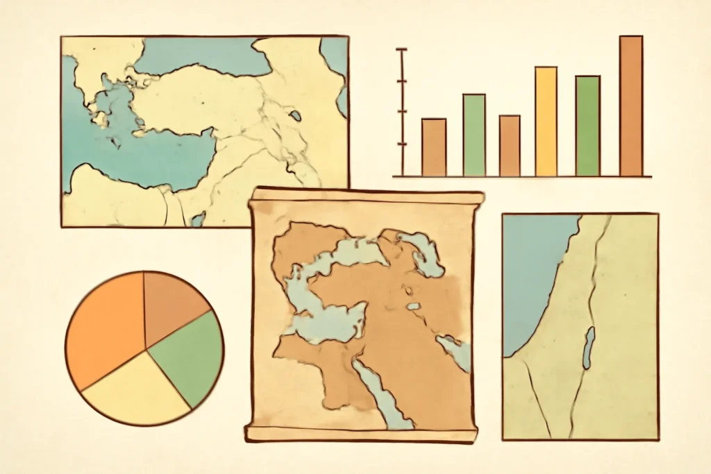
Biblical maps and charts are more than decorative illustrations in a Bible atlas. They are tools for understanding how geography shaped history, culture, travel, trade, and spiritual narratives in the biblical world. From the arid deserts of the Sinai to the fertile hills of Judea, from the bustling ports of Phoenicia to the imperial corridors of Mesopotamia, maps provide a spatial context that helps readers read Scripture with greater discernment. This article offers a comprehensive guide to biblical geography, exploring the kinds of maps and charts you are likely to encounter, how to read them well, and how to use them responsibly in study, teaching, and worship.
In the broadest sense, biblical maps show where places mentioned in Scripture are located in relation to each other. They may indicate topography, political boundaries, or routes of travel. Charts, on the other hand, present data in a diagrammatic or tabular form, such as genealogies, timelines, or lists of territory assignments. Taken together, maps and charts give readers a multi-dimensional view of the biblical world: the physical terrain, the political map of ancient empires, the routes people followed, and the lineage and chronology that anchor biblical narratives.
Within this field you will encounter several overlapping kinds of representations:
Topographic maps that emphasize mountains, valleys, rivers, deserts, and seas.
Political or administrative maps showing borders and jurisdictions in different historical periods (Egyptian, Hittite, Assyrian, Babylonian, Persian, Hellenistic, Roman, etc.).
Thematic maps highlighting particular features such as tribal territories, exile centers, trade networks, or linguistic zones.
Journey or route maps tracing the movements of people across the biblical narrative (Exodus, Israelite wanderings, journeys of Paul).
Genealogical and chronological charts that organize people, lineages, and reigns in a way that complements spatial maps.
Historical development and sources
The practice of mapping biblical worlds has deep roots in antiquity and medieval scholarship, but modern, rigorous biblical cartography emerged with the rise of printed atlases and later digital mapping tools. Early Christian and medieval pilgrims used itineraries and notations to locate sacred sites. For example, Itineraria like the Itinerarium Burdigalense (the Bordeaux Pilgrim’s itinerary, ca. 333 CE) provided a route-based perspective on the Holy Land. In the centuries that followed, scholars compiled collections of place names, distances, and travel times, gradually evolving into the compendia that today are found in Bible atlases and study Bibles.
In recent decades, the rise of GIS (Geographic Information Systems) and digital databases has transformed biblical mapping. Modern maps can layer multiple datasets—topography, climate zones, historical-era borders, and archaeological site identifications—so readers can compare contexts across epochs. While digital tools have expanded access, they also require careful evaluation of sources and dating, because the same place name may refer to different sites in different periods.
Below is a structured overview of common map types you are likely to encounter. Each type serves a distinct purpose for study and reflection.
Topographic and physical maps: emphasis on terrain features—mountain ranges (e.g., Lebanon, the horns of Edom), rivers (the Nile, the Jordan, the Euphrates), seas (the Mediterranean), and deserts (Sinai, Negev). These maps help explain where events could take place and why certain routes were feasible or dangerous.
Political or empire maps: show the political boundaries and control of different powers during specific eras (e.g., Egyptian New Kingdom, Assyrian expansion, Persian satrapies, Hellenistic kingdoms, Roman provinces). They illuminate power dynamics and the movement of peoples and troops.
Tribal and land-allocation maps: depict which tribes received territory in the Promised Land, often overlaying the accounts in Joshua and Judges with later theological reflections on inheritance and blessing.
Journey and route maps: trace the movements of individuals or groups, such as the 40 years of wandering, the Exodus path, or Paul’s missionary journeys. These maps help readers visualize the sequence of events and the distances involved.
Genealogical charts: present lineages and royal succession. These charts support readers as they connect genealogies in Matthew and Luke, or the priestly lines in Chronicles, with geographic anchors when possible.
Timelines and chronological charts: offer a temporal spine to biblical history, helping learners place events like the patriarchal narratives, the exodus, the monarchy, and the exilic period in relative order.
Archaeological site maps: identify locations of interest based on excavations and identifications in the literature, often including notes about uncertainties or alternate identifications.
Trade and migration maps: illustrate ancient commerce routes, such as the Levantine inland routes, the spice and incense trade, and connections between Egypt, Mesopotamia, and Anatolia, shedding light on economic contexts.
Militarial and expedition maps: highlight campaigns and battles, such as campaigns of David, Jeroboam, or Pompey-era incursions, to help students understand strategic considerations and geography’s role in outcomes.
How to read biblical maps and charts well
Reading biblical maps is a disciplined practice. The aim is to extract meaningful information without over-interpreting the data. Here are core skills and cautions to guide your study.
Check the time frame: Every map is a snapshot. A single map may represent multiple eras; check the date range or accompanying captions to know which period is being depicted.
Understand the symbols and color-coding: Mountains, rivers, cities, ruins, caravan routes, and fortifications are often indicated by standardized symbols. Legends are essential for interpretation.
Note the scale and projection: Scales show distance; projections can affect perceived proximities. In some maps, distances are compressed for readability; in others, the scale is precise. Use the scale bar and, if possible, cross-check with known distances between landmarks.
Recognize variant spellings and toponyms: Ancient sites may have multiple names (e.g., Jerusalem = Jersh, Urusalima, Salem). Check footnotes or encyclopedic entries for variants and identifications in the period you study.
Distinguish places from events: Some maps mark routes (a journey), while others mark settlements (cities). A route line may lie outside modern borders or may jump across regions that were relevant only in a specific era.
Read legends and notes: The most valuable maps provide notes on dating, sources, and uncertainties. Pay attention to these annotations.
Cross-reference with textual data: Use the map alongside the biblical text. Map features should illuminate, not replace, the narrative and theological themes.
Be mindful of speculative identifications: Archaeology and geography often identify candidate sites with varying levels of certainty. Distinguish confident identifications from tentative ones, and look for qualifiers like “possible,” “likely,” or “traditionally identified.”
Major geographic regions in biblical maps
A coherent study of biblical geography requires familiarity with key regions that recur in Scripture. Here is a concise guide to the main areas and their significance.
Nile Delta and Egypt: The cradle of Israelite history in the book of Exodus, as well as the setting for Joseph’s story, and later imperial power during the Exodus and the periods of captivity.
Sinai and the Wilderness: The route from Egypt to Canaan through the Sinai Peninsula, including the route of the Exodus and the encampments at Kadesh-Barnea and other stations.
Palestine / Canaan: The land promised to Abraham’s descendants and the setting of the conquest narratives, tribal allotments, and the united and divided monarchies. This region includes coastal plains, central mountains, and the Jordan Rift valley.
Transjordan: Moab, Edom, and Ammon areas east of the Jordan River. These regions figure in narratives about journeys, battles, and prophecies affecting Israel and surrounding peoples.
Phoenician and Syro-Palestinian coastal regions: Cities like Tyre, Sidon, and Acco play roles in trade, diplomacy, and prophetic or narrative references in the books of Kings and the Prophets.
Mesopotamia and the Fertile Crescent: The heartland of empires that interacted with Israel and Judah at various times, including Assyria and Babylon, with influence extending to Persia and beyond.
Asia Minor and the Aegean: The theater for Paul’s missionary journeys, early Christian networks, and the spread of the Gospel into the Greco-Roman world.
The Levantine interior and desert routes: The highland routes, wadis, and caravan paths that shaped camels, traders, and military campaigns.
Journey maps and itinerary-style charts
A distinctive family of biblical maps traces the movements of people through space and time. These journey maps and itinerary charts illuminate narrative arcs by providing distances, stops, and pacing. The most famous examples include the Exodus wanderings and the apostolic journeys recorded in the Acts.
Exodus and wilderness wanderings: A route map can trace the path from Egypt toward Mount Sinai and beyond, with encampment sites and short-halt stops. Such maps clarify why the Israelites turned north toward Kadesh-Barnea and how desert terrain shaped their experiences.
Paul’s missionary journeys: Maps of Paul’s three (or more) journeys highlight stops in Cyprus, Asia Minor, Greece, and other cities. These routes help readers understand the spread of early Christian communities and the geographic scope of Paul’s mission.
Prophetic missions and exile journeys: Some charts depict how prophets traveled or how populations were relocated, such as the Babylonian Exile, with routes indicating deportation corridors and settlement zones.
Land allotment and tribal maps
In the book of Joshua and in later prophetic writings, the land of Canaan is described as divided among the tribes of Israel. Land-allocation maps overlays help readers visualize the distribution of territory, the borders between tribes, and the geographic logic of settlement patterns. Some maps also integrate the Temple location in Jerusalem with tribal boundaries to show sacred geography.
Tribal allocations: Maps that show the twelve tribes and their approximate land shares, often with the Jordan River as a central reference point.
City and frontier demarcations: Some charts include key cities, border markers, and natural features that defined territorial limits.
Prophetic perspectives on geography: A few maps reflect prophetic visions about the geography of blessing and judgment, linking spatial layout with theological themes.
Genealogical charts and timelines
Family lines and reigns matter in biblical interpretation, and genealogical charts alongside chronological timelines provide context for events and theological themes. Although geography remains spatial, genealogies connect people and places, anchoring narratives in time.
Genealogies in Matthew and Luke: Charts that outline the lineage from Abraham to Jesus, often cross-referenced with historical dates and regions to illustrate the continuity of Israel’s story.
Royal dynasties: Timelines of kings in Israel and Judah help readers place battles, alliances, and religious reforms in geographic context.
Exilic and post-exilic chronologies: Timelines that show the Babylonian exile, the return under Persian authorization, and the rebuilding of the Temple, connecting political events with sites and regions.
Reading maps alongside textual geography
A robust approach to biblical maps treats them as companions to the text. When you read a map, you should be asking:
What is the period? What empire or political boundary is in effect, and when does this map apply?
What events are highlighted? Are we tracing a journey, a campaign, or the settlement of a land?
What is the relationship between geography and theology? How does geography illuminate promises, covenants, or prophetic judgments?
What narratives rely on geography? Consider how the experience of deserts, mountains, and sea crossings shapes character and plot.
Common map features and symbols you may encounter
Although publisher conventions vary, many biblical maps share a common palette of features. Here are some elements to recognize.
Capitals and cities marked with dots or circles; larger cities may be highlighted with bold labels.
Rivers, seas, and lakes shown with blue lines and shading to indicate water bodies.
Deserts and arid zones often shaded with pale tones to show harsh terrain.
Mountains and highlands depicted with contour lines or hatch marks; the distance and altitude influence travel routes and settlement choices.
Trade routes indicated by dotted or colored lines showing caravans or sea lanes.
Empire boundaries displayed as solid or dashed borders reflecting the historical period in focus.
Legend and date sections that explain symbols and indicate the historical window represented by the map.
Digital maps and modern tools
The digital age has opened abundant possibilities for exploring biblical geography. You can work with interactive maps, layered datasets, and searchable gazetteers to deepen your understanding.
Interactive online maps: Many Bible atlases provide zoomable maps with overlays for different epochs. You can toggle features such as “Israelite settlement,” “Assyrian borders,” or “Pauline journeys.”
GIS and layered datasets: GIS allows researchers to stack layers such as historical borders, topography, climate, and archaeology sites, enabling complex spatial analysis.
Digital atlases and Bible study apps: Apps and websites offer searchable place names, historical timelines, and cross-references to biblical passages.
Ethics of interpretation: Digital maps should be used with care—confirm identifications and dates against reputable scholarly sources, and be mindful of uncertain identifications in ancient geography.
For educators and students, digital maps can be used to create engaging activities such as map-based questions (e.g., “Identify the likely route from Egypt to Canaan,” or “Place the sites of Paul’s journeys on a blank map and discuss geographic constraints”). They can also support classroom demonstrations of how geography shaped biblical events.
Major map resources and how to choose them
When selecting maps or charts for study, consider the following criteria to ensure reliability and usefulness.
Historical period coverage: Look for maps that specify the historical epoch (e.g., Bronze Age, Iron Age, Neo-Assyrian period, Roman era). This helps avoid conflating features from different times.
Source transparency: Favor maps with clear references to sources, such as archaeological reports, inscriptions, or ancient itineraries, and with citations for disputed identifications.
Scholarly consensus and caveats: Some identifications are widely accepted, while others are debated. Good maps will acknowledge uncertainties along with confident identifications.
Scale and precision: For classroom use, you may prefer general, readable maps; for academic work, you may need precise scale and coordinate information.
Cross-border consistency: When using multiple maps, check for consistency in place names and border delineations to avoid confusion.
Some popular categories of reference works include bible atlases, commentaries with maps, and archaeological corpora that include site plans and regional maps. Each of these has strengths: atlases typically provide broad coverage and teaching-friendly visuals, while scholarly volumes focus on contentious identifications and up-to-date evidence.
Case studies: practical examples of map use
The following case studies illustrate how maps can illuminate specific biblical narratives.
Exodus routing and desert geography: A journey map of the Exodus can help students visualize why the people wandered for 40 years. By comparing maps that place Kadesh-Barnea near the southern border of Canaan with alternate identifications near Petra or in other Negev locations, learners grapple with textual clues, caravan logistics, and desert topography.
Paul’s missionary journeys and urban networks: An itinerary map of Paul’s journeys highlights his connectivity with major urban centers in the Greco-Roman world, as well as the challenges posed by sea travel and land routes. A thematic overlay showing synagogues, churches, and house churches provides a richer sense of early Christian geography.
Temple geography and Jerusalem’s sacred landscape: A map focusing on Jerusalem, the Temple Mount, and surrounding hills helps readers appreciate the sacred geography of Judaism and early Christianity. The overlay of nearness to the Kidron Valley, the Mount of Olives, and the acropolis adds depth to readings of prophetic or gospel passages.
Ethical and methodological cautions
Geography can illuminate Scripture, but it can also tempt readers to assert spurious claims about places and events. It is important to approach biblical maps with methodological care.
Acknowledge uncertainty: Not every place mentioned in the Bible has a secure archaeological site. Distinguish between well-supported identifications and hypotheses that are debated.
Avoid conflation of periods: Do not assume that a map labeled for one era represents another era with the same borders or routes.
Be wary of over-precision: Ancient distances were measured differently, and some routes are reconstructed based on textual cues rather than tight measurements.
Respect cultural and religious sensitivities: Maps that relate to sacred spaces should be used with reverence and awareness of diverse faith perspectives.
Integrating maps into study and teaching
For students, maps are not decorative add-ons but cognitive tools. They help learners organize information, test hypotheses, and engage with Scripture in a multi-sensory way.
In-class activities: Build a blank map of a region and invite students to plot important sites, routes, and boundaries for a given biblical period.
Homework tasks: Compare two maps that depict the same event but reflect different scholarly identifications, and prepare a brief analysis of differences and rationales.
Sermon and Bible study aids: Use journey maps to illustrate passages about pilgrimage, exile, or mission, and reference tribal or regional maps to deepen listeners’ understanding of oppression, blessing, or covenantal promises.
Glossary of key terms
Below is a concise glossary to help readers navigate common terms in biblical mapping and geography.
Topography: The physical features of the land, including mountains, valleys, rivers, and deserts.
Itinerary: A planned route or journey, especially one described in historical texts.
Hydrology: The distribution and movement of water bodies, such as rivers and seas.
Ethnography: The study of the distribution and characteristics of peoples or tribes within a region.
Cartography: The science or practice of making maps.
Chronology: The arrangement of events in the order of their occurrence in time.
Toponym: The name of a place, which may have variants in different periods or languages.
Archaeology: The study of human history through excavation and analysis of material remains, often contributing to site identifications on maps.
Conclusion: embracing biblical maps and charts
Biblical maps and charts are valuable companions for anyone seeking a deeper understanding of Scripture and its world. They bridge text and terrain, illuminate the journeys of people and the rise and fall of empires, and reveal how geography and history shape biblical narratives and spiritual themes. By using maps thoughtfully—recognizing periods, identifying uncertainties, comparing multiple sources, and integrating them with careful reading of the text—you can gain insights that enrich your study, teaching, and faith.
Whether you are a student preparing for a seminar, a pastor preparing a sermon, or a curious reader exploring the biblical world, remember that maps are interpretive tools. They accompany the text; they do not replace it. Embrace the breadth of biblical geography—from the Nile’s reach to the hills of Galilee, from city walls to caravan routes—and let the landscapes of Scripture deepen your understanding of its message.







Leave a Reply