Introduction: Why a guide to the ancient bible map matters
For scholars, students, and curious readers alike, understanding the world described in the ancient Bible map is more than a matter of location. It is a doorway into how people in antiquity viewed territory, travel, power, and faith. A biblical map from antiquity or the medieval world offers clues about trade routes, military campaigns, pilgrimage paths, and the geographic ideas that shaped sacred narratives. This article, Ancient Bible Map: The Ultimate Guide to Biblical Geography and Historic Routes, serves as a comprehensive primer on the history, sources, interpretations, and modern uses of ancient maps of the Bible, as well as how readers today can engage with them responsibly and imaginatively.
We will explore what makes an ancient bible map distinctive, review landmark examples, and outline how modern technology—GIS, digitization, and careful textual study—brings new light to biblical geography. Along the way, you will encounter key places, routes, and landmarks that recur across both Old and New Testament worlds, from the reaches of Egypt and Mesopotamia to the cities of the Levant and the shores of the Mediterranean.
What is an ancient biblical map?
An ancient map of the Bible is not only a diagram of borders. It is a product of cultures, purposes, and languages. Such maps show how people in antiquity understood the Holy Land, the surrounding empires, and the routes that connected people to events described in biblical narratives. They may be:
Cartographic representations embedded in manuscripts, mosaics, or travel itineraries.
Topographic sketches that highlight sacred sites, cities, and roads.
Symbolic or theological maps that emphasize pilgrimage routes or covenant geography.
The phrase ancient bible map covers a spectrum of artifacts and texts—from the cartographic sketches of late antiquity to the more schematic diagrams found in medieval manuscripts. The goal of these maps is often not to provide a precise modern-scale atlas but to situate biblical events within a recognizable landscape, to guide readers through sacred history, or to assist pilgrims and merchants traveling through the Near East and southern Europe.
Variations of the term
In scholarship you will encounter several variations on the core idea. Some writers prefer ancient map of the Bible, others call it a biblical geography map or a biblical atlas. A biblical antiquity map might emphasize chronology, while an antique Bible chart could foreground sites connected to patriarchs, kings, prophets, or apostles. Recognizing these variations helps in searching archives, libraries, and digital collections where different traditions of cartography survive.
The historical context of biblical cartography
To understand the ancient bible map, one must place it in its historical moment. The regions around the eastern Mediterranean were home to powerful empires: Egypt, Assyria, Babylonia, the Persian Empire, and eventually the Hellenistic and Roman worlds. Each of these powers relied on networks of roads, rivers, and coastal routes that shaped how antiquity’s mapmakers imagined space. Biblical geography emerged at the intersection of political geography, religious memory, and travel experience.
Early mapmaking in this region was often practical rather than purely cartographic. Mariners and caravan traders created itineraries that recorded distances, stations, and hazards. Emperors and temple authorities commissioned layouts to display legitimacy or sanctity. As a result, many ancient biblical maps incorporated:
Descriptions of nearby cities and routes used by travelers and soldiers.
Names drawn from biblical, temple, or imperial sources that helped readers identify sacred places and key sites.
Scale and orientation that reflect religious emphasis more than geometric precision.
Over centuries, these maps were reshaped by scribal practices, theological concerns, and evolving geographic knowledge. The process produced a living tradition of biblical geography maps that continues to inform modern scholarship and popular understanding of biblical events.
Regions, routes, and the geography they illuminate
A solid grasp of biblical geography requires locating major regions and tracing the pathways that literature connects to sacred narratives. Below are some of the key areas that repeatedly appear in the ancient bible map tradition, along with representative routes and sites.
The Levant and the inland routes in the Promised Land
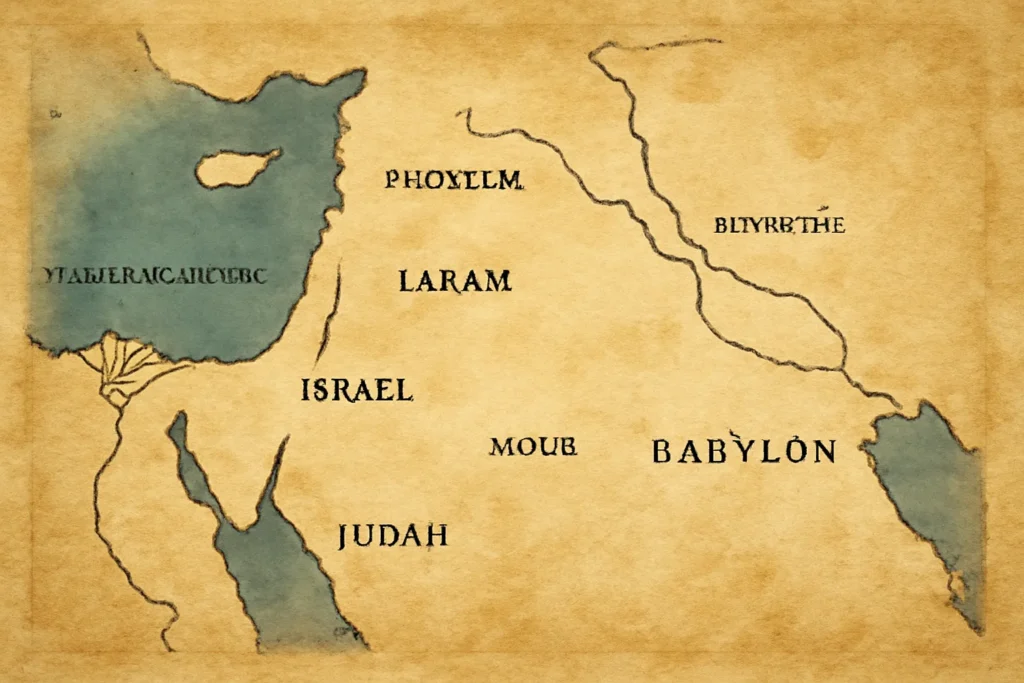
The Levant, sometimes called the Near East or the eastern Mediterranean littoral, is the core theater for many biblical episodes. In an ancient map of the Bible, expect to see major cities such as Jerusalem, Jericho, Bethel, Hebron, Sidon, Tyre, and Damascus, connected by roads that reflect caravan networks and military campaigns.
Travelers and readers encountered the land broadly described as the Promised Land, a concept extending beyond political borders to include sacred geography. Maps and itineraries highlight valleys, mountains, and river systems (for example, the Jordan River and its crossings) that anchor events in narrative memory.
The interplay between Egypt and Canaan is central to many biblical accounts. An ancient map of the Bible may outline entry points to Canaan via Sinai or through the Nile delta, with routes linking cities such as Memphis, Heliopolis, and Ramesses, and eventually leading to wilderness sites associated with the Exodus.
The visual emphasis often centers on the Red Sea or Gulf of Suez crossing, as well as the routes patterned after desert travel. While the exact geography of the Exodus remains debated among scholars, a traditional mapmaker’s view frequently places scholars’ consensus routes in proximity to well-known desert landmarks, guiding readers through the narrative arc from slavery to covenant.
Mesopotamia, Anatolia, and the broader cradle of civilizations
Beyond the western margin of the Levant, ancient mapmakers placed Mesopotamia (the land between the Tigris and Euphrates), western Iran, and parts of Anatolia (modern Turkey) as important hinterlands. For biblical readers, these regions provide context for narratives about patriarchs, kings, and kingdoms that interacted with or opposed the people of Israel.
The influence of these regions on biblical geography maps is often framed through rivers (like the Tigris, Euphrates, and Euphrates-like tributaries), imperial routes, and caravan networks that linked cities such as Nineveh, Ur, Harran, and Carthage-connected hubs in the western Mediterranean. Even when not labeled exactly, these environs shape the sense of distance and power that a reader encounters in the text.
Notable ancient biblical maps and cartographic works
While not every artifact is a formal “map” in the modern sense, a number of celebrated pieces and textual itineraries stand out for their influence on how we visualize biblical geography. Here are some landmark examples and related traditions that a student of the ancient bible map should know.
The Madaba Map: Mosaic geography in a Byzantine collection
The Madaba Map (6th century CE, in present-day Jordan) is perhaps the most famous surviveing example of a recognized biblical geography text visually realized as a map. This floor mosaic, embedded in a church in Madaba, depicts Palestine and surrounding regions with remarkable detail for its time. It highlights cities, routes, Topography, and religious sites—the sort of material culture that helps scholars understand how early Christians in the Byzantine era imagined holy space.
For students of the biblical geography map, the Madaba Mosaic is more than a pretty image: it is a source that clarifies how people in late antiquity oriented sacred geography, and it reveals how cartographers reconciled biblical memory with present-day geography.
Stadia and itineraries: The Itinerarium and related Roman route books
The ancient world produced a family of travel documents that operate like ancient maps of the Bible in an itinerary sense. Notable examples include the Itinerarium Burdigalense (the Bordeaux Itinerary), which traces pilgrim routes from Rome to the Holy Land, and the Stadias (the Stadiasmus Maris Magni), which outlines ports and sea routes around the Mediterranean. While these are textual guides rather than pictorial maps, they provide essential spatial data that modern reconstructions use to infer historical geography.
Ptolemaic and Hellenistic cartography: Early world maps reimagined
The legacy of Ptolemaic maps extends into discussions of biblical geography because Claudius Ptolemy’s world view organized space in latitude-longitude coordinates and drew on sources from Egypt, Mesopotamia, and the Levant. Although the original Ptolemaic maps do not survive intact, later copies and interpretations influenced medieval and Renaissance biblical geography maps, shaping how readers understood biblical sites within a broader cosmological framework.
The Tabula Peutingeriana and other road maps
The Tabula Peutingeriana (The Peutinger Table) is a Roman road map that, while not exclusively biblical, intersects with biblical geography in meaningful ways. It charts roads, stations, and distances across the Roman world, including connections between the Levant and western ports. For a reader of ancient bible maps, this is a crucial cross-reference that helps translate biblical events into travel reality—where caravans and legions would have moved, how long journeys took, and which routes were most traveled.
Several other artifacts, such as early medieval mappaemundi, regional portolans, and church-donor maps, contribute to the broader corpus of ancient biblical maps. They often emphasize pilgrimage sites and sacred geography more than political borders, but they remain essential for understanding how antiquity readers encountered the biblical world in spatial terms.
How ancient maps shaped interpretation and archaeology
Maps from antiquity do more than locate places; they shape interpretation. A biblical geography map frames narratives by choosing which places to highlight and how to connect them. A road-laden layout may emphasize travel and exile, while a map focused on cities might underscore political power or religious centers. The choices mapmakers made carry theological and cultural implications.
For archaeologists and biblical scholars, ancient maps provide hypotheses about where sites might lie, how ancient peoples understood distance, and how transport networks shaped daily life. Even when a map is imperfect or contains symbolic features, its value lies in revealing the cartographer’s priorities and the audience’s expectations.
Modern revival and digital tools in biblical cartography
In recent decades, scholars and educators have produced a new generation of ancient bible maps through digital humanities. GIS (Geographic Information Systems), 3D reconstructions, and online atlases allow researchers to:
Overlay biblical texts with archaeological data to test routes and sites.
Experiment with alternative routes in narratives such as the Exodus or Paul’s missionary journeys.
Publish open-access maps and datasets that enable students and teachers to explore geography interactively.
Projects often incorporate modern discoveries—like new port sites, caravanserai locations, or satellite imagery—to refine our understanding of the biblical geography map in ways that would have been impossible a generation ago.
How to read an ancient bible map: tips for students and enthusiasts
Reading a ancient map of the Bible requires careful attention to context and a degree of methodological humility. Here are practical guidelines to get the most from these artifacts:
Identify the purpose: Is the map meant to guide pilgrimage, illustrate political power, or highlight sacred sites? The purpose affects what is depicted and how distances are imagined.
Note the orientation: Many ancient maps use eastward orientation (the rising sun) or a top-down convention that differs from modern north-up layouts. Don’t assume a fixed orientation without a clear key.
Assess the scale and precision: Ancient maps rarely aim for modern accuracy. Distances may be symbolic, sites merged, and places renamed across periods.
Read accompanying text and iconography: In mosaics and manuscripts, symbols, colors, and labels carry religious or political messages that illuminate how communities understood space.
Consider source diversity: A single artifact may blend multiple traditions (Egyptian, Assyrian, Hellenistic, Christian) and layers of memory. Compare multiple sources to gain a balanced view.
Cross-reference with archaeology: When possible, map locations against physical remains, inscriptions, and material culture to test hypothetical routes.
By adopting a critical, comparative approach, readers can use the ancient bible map as a springboard for deeper inquiry rather than a fixed atlas.
Common themes and debates in ancient biblical cartography
The study of biblical maps is not free from controversy. Several recurring debates shape how modern readers interpret ancient geography:
Exodus routes: Which desert crossing best fits available evidence? Some maps emphasize a southern route via the Red Sea, while others propose crossings near the Gulf of Suez or through the northern Sinai. Each proposition carries interpretive consequences for geography and chronology.
Cities and sites: The identification of certain sites (for example, biblical places like Dan, Beersheba, or Bethany) is sometimes contested between textual readings and archaeological data. A given ancient map of the Bible may reflect a particular labeling tradition rather than a universally accepted list of cities.
Empire and caravan power: The way maps depict imperial routes can reveal how mapmakers understood political authority. A map might foreground the routes of kings or the influence of empire over local communities, shaping readers’ sense of geography and history.
Symbolic space vs. physical space: Some maps encode sacred geography through spiritual landmarks and cosmological symbolism, not only through real-world distances. This tension between symbolic and physical space is a core feature of many medieval and early modern biblical maps.
Using ancient maps of the Bible in education and research
For educators, ancient bible maps offer powerful ways to engage learners with geography, history, and sacred literature. They can be integrated into:
Classroom activities that compare biblical narratives with topographical features and archaeological findings.
Curriculum modules on ancient travel, empire networks, and religious history.
Digital projects that reproduce or reinterpret classic maps with modern data layers.
For researchers, maps function as hypotheses generators. A new site, an overlooked route, or a reinterpreted city label can prompt fresh questions about narrative chronology, trade networks, or religious pilgrimages.
Case study: tracing Paul’s journeys on a biblical geography map
The journeys of the Apostle Paul, as described in the Acts of the Apostles and the Epistles, offer a rich setting for exploring the use of the ancient bible map in a New Testament context. Modern reconstructions plot Paul’s missionary routes across Asia Minor and Greece, connecting his letters to cities like Antioch, Ephesus, Philippi, Thessalonica, Corinth, and Rome. While these maps cannot capture every nuance of travel (sea voyages, land travel, and crowded port towns), they illuminate the geographic logic of Paul’s mission: crossing cultural boundaries, establishing churches, and navigating imperial road networks.
In teaching terms, a ancient map of the Bible for Paul’s journeys helps students visualize how early Christian communities spread, how coastal routes and inland networks shaped ministry, and how geography intersected with theology and proclamation in the Roman world.
Creating your own modern interpretation of an ancient biblical map
If you want to engage with the subject beyond passive reading, consider a project to create your own ancient bible map. Steps might include:
Identify key sites mentioned in the biblical text and cross-check with reliable archaeological sources.
Select a map type that suits your focus (topographic sketch, route-based itinerarium, or a thematic map showing trade or pilgrimage routes).
Annotate sites with legend entries that explain their historical and religious significance.
Provide contextual notes about sources, dates, and potential uncertainties to encourage critical engagement.
Such a project, even if informal, helps readers appreciate the complexities of historical geography and the ways in which maps shape understanding of sacred narratives.
Where to find reliable resources on ancient biblical maps
If you want to explore further, here are categories of sources commonly used by scholars and enthusiasts:
Academic monographs and journal articles on biblical cartography, archaeology, and Near Eastern history.
Digital atlases and GIS projects that integrate textual data with geographic layers.
Manuscripts and mosaics that contain cartographic elements or place-names relevant to biblical geography.
Travel narratives and itineraries from the Roman and Byzantine eras that document routes and sites referenced in biblical texts.
When consulting these resources, keep in mind that interpretations evolve as new evidence emerges. The best practice is to cross-reference multiple sources and be transparent about the level of certainty associated with a given site or route.
Conclusion: The enduring value of ancient maps of the Bible
An ancient bible map is more than a guide to place names; it is a cultural artifact that reveals how readers in various eras perceived sacred space, traveled through conflict and commerce, and connected episodes of faith to particular landscapes. From the Madaba Map and Itinerarium Burdigalense to the Tabula Peutingeriana and Ptolemaic influence, the tradition of biblical cartography gifts us with a layered, long-term view of how geography and scripture inform one another.
In today’s classrooms and research labs, the study of the biblical geography map is a living discipline. As maps become more precise through digital tools and as archaeological discoveries refine our understanding of places and routes, our image of the biblical world continues to gain nuance. Whether you approach these works as a theologian, a historian, an archaeologist, or a curious reader, exploring the ancient bible map can deepen your appreciation for how ancient peoples understood space, movement, and memory—and how those ideas still resonate in modern interpretations of biblical narratives.





Leave a Reply