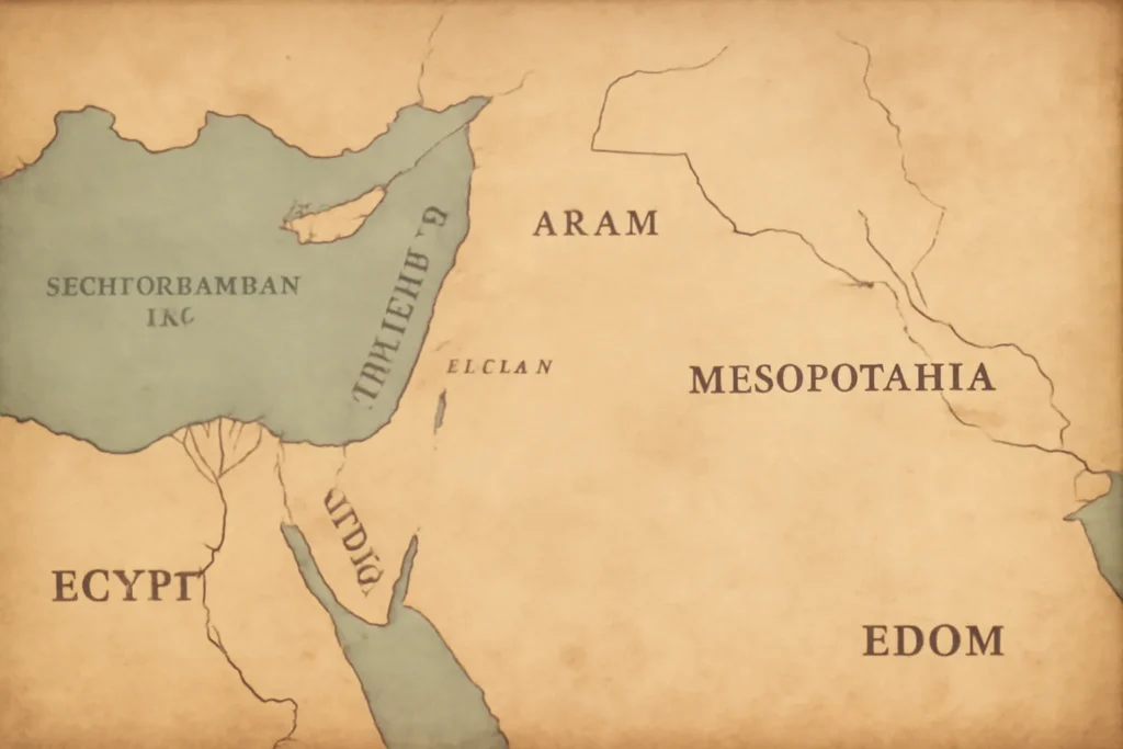
Ancient Bible maps are more than decorative illustrations; they are windows into how past scholars, scribes, and travelers imagined the biblical geography that anchors many sacred stories. From early descriptions in sacred texts to medieval reconstructions, these maps reveal evolving ideas about where places lie, how journeys unfold, and what regions mattered to communities shaped by faith. This guide surveys the landscape of ancient mapmaking as it intersects with biblical study, showing how different map traditions—regional itineraries, world-center plans, and later hybrid diagrams—help us read ancient sources with greater nuance. It also explains how modern scholars interpret, preserve, and creatively reconstruct these representations for teaching and research today.
At its simplest, an ancient Bible map is any historical representation that places places from the Biblical world within a spatial frame. Yet there is more variety here than a single “map.” Some are literal in tone, trying to mark the locations of events, cities, and routes. Others are symbolic, placing sacred sites at the center or weaving theological meaning into the geography. Still others are practical itineraries that echo the kinds of routes traders, pilgrims, and military leaders would have followed. Collectively, these maps cover a spectrum of forms, from ritual illustrations to proto-cartographic diagrams, each shaped by the culture and century that produced it.
Because ancient mapmakers often worked with fragmentary evidence, local traditions, and religious commitments, the resulting images intentionally mix core geography with sacred significance. The effect is not a modern, scale-accurate atlas but a set of useful tools for reading texts, locating places in memory, and understanding how communities related to the land described in sacred narratives. In this sense, ancient Bible maps are as much about memory and meaning as they are about measurement.
Historical Roots and Influences
The tradition of mapping the biblical world grows out of a long history of geographic imagination in the ancient and medieval Mediterranean region. Early Jewish and Near Eastern traditions included spatial descriptions embedded in liturgy, prophecy, and travel accounts. When Christian scholars later engaged with classical geographers, they inherited a toolkit of geography, cosmology, and gazetteers that could be adapted to scriptural sites. Two threads especially shaped the development of biblical maps:
Religious geography: places named in Scripture were tied to sacred memory, liturgical calendars, and pilgrimage practices. Maps served to orient readers to the geography of salvation history.
Classical cartography: Greek and Roman treatises provided methods for converting narrative places into configurable layouts, even if the results were not strictly to scale.
Two figures and traditions loom large in this story:
Eusebius of Caesarea and the Onomasticon, which catalogs biblical places with their modern correspondences and notes about distance or direction.
Hellenistic and Roman cartographic methods that informed early Christian scholars, who often adapted Ptolemaic ideas for biblical purposes.
Over time, as manuscript cultures flourished, map-like diagrams began appearing in explanatory glosses, commentaries, and illumined codices. In medieval and early modern periods, these would evolve into the famous mappaemundi and other hybrid diagrams that blended sacred geography with mythic or allegorical elements.
Categories and Variants of Ancient Bible Maps
Scholars today talk about several broad categories or variants of biblical maps. Each variant has its own purposes, conventions, and limitations. Here is a concise inventory of the most common forms you are likely to encounter when studying ancient biblical geography:
Regional itineraries: maps that trace journeys rather than present a global view. These often follow notable biblical routes—Abraham’s travels, the Exodus, or the roads traveled by Paul in the Acts—emphasizing landforms, rivers, and cities important to the story or to later commentators.
Holy Land-centric plans: maps that place Jerusalem or the Holy Land at the center. Such diagrams reflect devotional and liturgical priorities as well as spatial memory of sacred sites.
Gospel-era pilgrimage diagrams: diagrams that lay out routes of apostles or early Christian communities, sometimes with sea lanes or caravan routes highlighted to show travel times or connections to major ports.
World maps (mappaemundi) with biblical cues: medieval world maps that depict the known world with biblical events or places embedded in cosmological or theological symbolism, often oriented with East at the top and Jerusalem near center or within the map’s sacred core.
Itineraries and portolan-style charts: coastal charts and sea routes that show Mediterranean and Red Sea navigation in ways that intersect with biblical geography, even if the primary purpose is practical navigation rather than sacred mapping.
Topographic schematics: simplified, schematic diagrams that emphasize relative locations, distances, and relationships between places rather than precise measurements.
Within these categories there are many regional flavors and stylistic choices. Some maps prioritize a strictly geographic fidelity (as far as ancient sources and knowledge permit), while others foreground theological relationships, such as the land promised to the Patriarchs or the watershed geography of historical events.
For researchers, it is useful to track which variant a particular map uses, because that reveals the map’s intended audience, purpose, and underlying assumptions about space and sacred history.
Several figures and texts repeatedly shaped the practice of mapping biblical landscapes. Here are a few to know, along with the kinds of map they influenced.
Eusebius of Caesarea and the Onomasticon: A foundational reference work that ties biblical place names to modern equivalents and to distances and directions from biblical sites. It served as a bridge between sacred memory and geographic memory.
Ptolemy and the tradition of Geographia: Although not biblical in scope by itself, Ptolemy’s methods—grid-based coordinates, latitude and longitude approximations, and named place lists—were adopted and adapted by Christian scholars to situate biblical locales within a known world.
Itinerarium and travel literature traditions: Ancient itineraries that describe how to move from one sacred site to another contributed to the practical aspect of mapmaking, especially in pilgrims’ guides and early church histories.
Medieval mappaemundi and pilgrim maps: These works reimaged the world with spiritual topology in mind, often placing biblical events in narratively meaningful locations rather than in geographic precision.
Two illustrative subsections help illuminate how these figures operated in practice.
Eusebius of Caesarea and the Onomasticon
In the Onomasticon, Eusebius compiles a gazetteer of biblical sites with cross-references to places known in his era. While not a map in the modern sense, it functioned as a geographic index that could accompany a map or be used to interpret passages in light of a place’s known relative position. This kind of scholarly tool is essential for understanding how later cartographers anchored their diagrams in textual tradition.
Ptolemy and Early Christian Cartography
Ptolemy’s Geographia offered a coordinate-based framework that Christian scholars reused to situate biblical cities. In the hands of Christian editors, such technology allowed biblical geography to enter debates about empire, travel, and mission, even as the spiritual meaning of the places remained central to interpretation.
Materials, Techniques, and Representations
Ancient and medieval mapmaking relied on materials and techniques that differed from modern cartography. Knowledge of geography was transmitted through manuscripts, parchments, and sometimes painted walls or frescoes. The following elements were common:
Manuscript materials: parchment and vellum in the medieval period, and papyrus or parchment in the late antique era. The durability and texture of these materials influenced how maps were drawn and preserved.
Illustration techniques: hand-drawn borders, city markers, rivers, and mountains were sketched with ink and color, sometimes accompanied by marginal glosses that explained what the viewer should understand about the placement.
Symbol systems: maps used recurring symbols for cities, churches, sacred sites, and trade routes. Symbols were often not standardized across cultures, so readers needed to learn the local lexicon.
Scale and measurement: most ancient maps were not to scale in the modern sense. Distances were approximated, and the relative importance of places often outweighed exact geometry.
Despite these constraints, many maps achieved remarkable coherence. A map’s usefulness lay less in mathematical precision and more in its ability to orient a reader within a familiar space, to recall stories, and to guide pilgrimage or sermon discourse.
In addition to hand-drawn maps, pilgrim itineraries and cathedral codices sometimes included schematic or narrative “maps” that pointed readers toward the most important sacred sites or routes, often with experiential directions (e.g., “go up, turn east, and follow the river to the next shrine”).
How to Read an Ancient Bible Map
Reading an ancient biblical map requires attention to context, purpose, and the conventions of its time. Here are practical tips to approach these diagrams with care and curiosity:
Identify the orientation: Some maps place East at the top (corresponding to the biblical sense of the Holy Land facing the rising sun), while others center on Jerusalem or the Jordan River, reversing the usual Western north-up orientation. The orientation often signals religious priorities rather than navigational accuracy.
Look for symbolic emphasis: Sacred sites—Jerusalem, Bethlehem, Nazareth, Mount Sinai—are often highlighted. The map may intentionally foreground these places, even if surrounding geography is schematic.
Check the scale and boundaries: Do not expect precise distances. Distances, if given, are approximate and may reflect liturgical or narrative purposes rather than a surveying standard.
Note the source and era: Is the map a medieval mappa mundi, a pious pilgrim diagram, a Ptolemaic-inspired chart, or a vernacular copy? Each informs how to interpret color, symbol, and arrangement.
Understand the audience: Maps made for priests, pilgrims, merchants, or students may prioritize different features—clerical geography, pilgrimage routes, or economic networks.
Cross-reference with textual cues: Biblical passages, commentaries, and marginal notes can reveal how readers expected to locate places and understand their relationships to events.
With these careful steps, a reader can appreciate how a map communicates more than place names: it communicates faith, memory, and a worldview about how the sacred space of the Bible sits within the world.
Modern Revisions, Digital Reconstructions, and Educational Uses
In recent centuries, scholars have reimagined ancient biblical maps with new tools and questions. The rise of digital humanities and GIS has opened opportunities to test the assumptions behind traditional maps, create alternative geographical scenarios, and present the data in ways accessible to classrooms and public audiences. Here are several ways modern scholars engage biblical geography:
Digital atlases and online repositories that host high-resolution images of medieval mappaemundi and early Christian charts, often with scholarly annotations and transliterations of place names.
Geospatial analyses that overlay biblical place names onto contemporary maps, enabling researchers to discuss proximity, travel times, and ecological contexts across ancient landscapes.
Renaissance and Enlightenment re-interpretations where scholars revisited the classical tradition and reinserted biblical geography into a broader world map narrative.
Educational projects that present “map-driven” storytelling for students, helping learners connect Biblical events with terrain features such as rivers, seas, deserts, and mountain ranges.
In the classroom and in public history projects, modern reconstructions emphasize three goals: better source criticism of the maps themselves, richer geographic context that helps learners grasp terrain and climate, and an awareness of how mapmakers’ intent shapes the representation of sacred history.
Myths and Misconceptions About Biblical Maps
As with many historical artifacts, biblical maps invite myths as well as insights. Here are a few common misconceptions, along with clarifications grounded in scholarly practice:
Myth: Ancient maps were precise, scale-accurate representations. In reality, most maps prioritize narrative, liturgical, or doctrinal aims over strict measurement. Precision is rare; comprehension is the aim.
Myth: All biblical maps depict a single orthodoxy. Variants reflect diverse traditions, denominations, and regions. Cross-cultural exchange influenced how places were pictured and discussed.
Myth: Maps erase local topography. While some maps are schematic, many preserve recognizable topographic cues—rivers, mountain ranges, coastlines—that help viewers locate familiar places within a broader landscape.
Myth: Jerusalem is always central in medieval maps. While many mappaemundi do elevate Jerusalem, not all maps center on it. Some place the Holy Land at the edges or distribute sacred sites in a cosmological frame.
Separating these myths from evidence helps readers understand what a map can and cannot tell us about ancient perception and practice.
Examples of Ancient Bible Maps: What You Might Encounter
To ground this discussion, it helps to name representative examples and the kinds of information they typically convey. Note that the images themselves vary widely across manuscripts and regions.
Pilgrim’s guides from the late antique and medieval periods: These often combine textual itineraries with small schematic maps showing the route from a starting point to several holy sites in the Holy Land.
Onomasticon-inspired diagrams: Maps that annotate places named in Scripture with notes on where they correspond in regional geography, sometimes showing a rough east–west orientation and distances between features.
Jerusalem-centered charts: Diagrams that place Jerusalem at or near the center, with surrounding cities and regions arrayed to emphasize sacred geography and pilgrimage logic.
World maps with biblical insertions: Medieval mappaemundi that blend cosmology and Biblical geography, sometimes featuring parables or theological narratives woven into the spatial fabric.
Coastal portolan-style charts: While primarily navigational, these charts sometimes mention biblical sites along the Levantine coast, offering a practical view of sea routes and trading hubs alongside sacred references.
Each example demonstrates how mapmakers balanced evidence, tradition, and spiritual aim, producing diagrams that could be used in worship, teaching, or travel planning.
Below is a concise glossary to help readers navigate discussions of biblical cartography. Terms are bolded in the text where they first appear for emphasis.
Map projection: The method by which a 3D surface (the world) is drawn on a 2D plane. In ancient maps, projections were not uniform and often prioritized literature and theology over mathematical accuracy.
Mappa mundi / mappaemundi: Medieval European world maps that depict the known world with a blend of geography, history, and theology.
Thematic map: A map that emphasizes a particular theme—such as pilgrimage routes, sacred sites, or routes of prophets—over general geography.
Onomasticon: A type of gazetteer listing place names with identifications and notes, crucial for tying biblical places to real locations in antiquity.
Itinerary: A written or visual guide to a journey, often used in pilgrim literature to describe routes between sacred places.
Topographic schematic: A simplified diagram that highlights the relative positions and relationships of places rather than exact distances.
Why These Maps Matter Today
Ancient biblical maps matter for several reasons beyond their historical intrigue:
Historical insight: They reveal how past readers understood sacred geography and how that understanding influenced liturgy, theology, and travel.
Textual interpretation: Maps are interpretive tools that illuminate how specific passages were read in different periods, clarifying allusions to places and journeys described in Scripture.
Educational value: For students and the general public, maps provide a tangible sense of the landscapes that shape biblical narratives, deepening engagement with the texts.
Preservation and digital access: Modern digitization and scholarship preserve fragile manuscripts while enabling wider access to rare cartographic artifacts.
Today, educators and researchers combine careful source criticism with new technologies to present biblical geography in ways that respect historical context while inviting fresh inquiry. The result is a more nuanced understanding of how the biblical world was imagined across centuries.
Further Reading and Resources
For readers who want to continue exploring ancient bible maps and biblical geography, here are some starting points across different formats and audiences:
Introductory surveys of biblical geography in print and online encyclopedias
Monographs on Eusebius, the Onomasticon, and early Christian cartography
Editions and translations of key medieval mappaemundi and pilgrim maps
Digital atlases and GIS projects that overlay biblical places onto modern maps
Note: Seek sources from reputable publishers and academic presses, and be mindful of the date of publication, as scholarship in this field evolves with new manuscript discoveries and digital techniques.
Conclusion: A Map for the Mind and the Land
Ancient Bible maps offer more than geographic layouts; they offer a window into the correlation between land and sacred narrative. They show how communities located themselves in memory, how they oriented themselves to sacred locations, and how they communicated these ideas across generations. Whether framed as itineraries, Jerusalem-centered diagrams, or world maps that blend faith with cosmology, these diagrams remind us that geography in the biblical imagination is inseparable from theology, memory, and pilgrimage. By studying the varieties of ancient biblical cartography, readers gain a richer sense of how the biblical story traveled across continents and ages, shaping the way believers understood where they stood in relation to the places where faith unfolded.
As our methods evolve—through digital visualization, critical textual analysis, and collaborative scholarship—we can continue to uncover the multiple layers that make ancient biblical maps not only instruments of navigation but also enduring narratives about belonging, identity, and the sacred geography of the past.




Leave a Reply