Maps are more than pretty pictures in a geography textbook. For children, kid-friendly geography helps turn Bible stories into places they can see, touch, and imagine. When a child can locate Bethlehem, follow the Jordan River, or trace the Exodus route on a map, the narrative becomes spatial and alive. This is the core idea behind children's bible maps: simple, colorful, and approachable representations of biblical geography that reinforce memory, encourage curiosity, and connect sacred stories to real places in the world. In this article, you’ll discover what these maps are, why they matter, how they’re designed for kids, and practical ways to use them at home, in the classroom, or in faith communities.
What are children’s Bible maps?
Children’s Bible maps are specialized map resources that present biblical geography in a form that is easy for children to understand. They may appear as wall posters, fold-out booklets, or digital overlays, but they share several common characteristics. They emphasize clarity over complexity, use bright colors and friendly icons, and pair spatial information with familiar Bible passages or stories. Instead of overwhelming a reader with every possible ancient city, they highlight the most meaningful locations tied to the narratives children are studying. This simplified approach helps kids build a mental atlas that grows with them as they learn more about the Bible and the world it describes.
Accessibility: Large labels, bold borders, and readable legends make it possible for younger children to follow along without getting lost.
Story-centered design: Maps are often linked to a specific Bible narrative, such as the journeys of the patriarchs, the Exodus, or the life of Jesus, so geography serves the story.
Engaging visuals: Icons for landscapes (deserts, seas, rivers), animals, and cultural landmarks help children connect place names to imagery.
Multiple formats: From durable wall maps to foldable booklets and interactive apps, there are kid-friendly map formats to fit different settings.
As you explore varieties of children’s bible maps, you’ll notice that the same goal threads through them all: turning abstract place names into a concrete sense of place. This is what makes biblical geography a powerful educational tool for kids.
Why maps matter in children’s Bible education
There are several compelling reasons to incorporate maps into Bible learning for children. When young readers can see where events unfold, they develop spatial thinking, improve memory for narratives, and gain a context for historical and cultural details. Here are key benefits of using kid-friendly Bible maps:
Context and comprehension: Geography situates stories in real places, helping kids understand why events happened where they did.
Memory cues: Visual landmarks and routes serve as mnemonic anchors for recalling biblical details.
Cross-curricular links: Geography concepts such as scale, distance, direction, and map features align with science and history curricula.
Faith formation: Seeing sacred sites can deepen a sense of awe and connection to biblical narratives, making the stories feel present rather than distant.
Early map literacy: Children practice reading legends, scales, compass roses, and grid systems—foundational skills for more complex maps later on.
Different variations of children’s Bible maps support diverse learning goals. Some maps emphasize historical routes, others highlight biblical timelines, while others blend geography with cultural and archaeological context. Regardless of format, the core aim remains the same: make geography friendly, memorable, and meaningful for young learners.
Key features of effective children’s Bible maps
Not all maps labeled for kids are equally useful. Great child-friendly Bible maps share several essential features that support learning and engagement. Below are the common characteristics you’ll encounter across effective designs:
Clear legend and symbols: A concise legend explains icons (cities, seas, rivers, deserts, routes) in kid-accessible language.
Age-appropriate scale and focus: Small-scale maps for broad overviews and larger-scale inset maps for key regions allow flexibility in instruction.
Color-coding and contrast: Distinct colors differentiate locations, routes, and timelines without overwhelming visual clutter.
Story integration: Maps are paired with short narrative prompts or Bible verses that anchor geography to a story.
Maps with interactivity (digital or tactile): Digital overlays, click-through questions, or tactile pieces invite hands-on exploration.
Contextual information: Sidebars with historical notes, cultural context, or archaeological findings add depth without slowing pace.
Durability and accessibility: Reusable magnets, sturdy posters, or large-format printing suit classrooms and family homes alike.
When selecting maps for kids, consider the learner’s age, reading level, and cultural sensitivity. A well-designed map can be revisited at different grades, each time revealing new layers of geography and scripture.
Design principles: how developers create kid-friendly Bible maps
Designing effective kid-friendly Bible maps is as much about pedagogy as it is about cartography. The designers aim to reduce cognitive load while increasing curiosity. Here are some guiding principles you’ll often see:
Incremental complexity: Start with a simple overview map and add detail in subsequent lessons or versions, so kids build confidence step by step.
Gestural and narrative integration: Maps work best when a teacher or parent can point out places while telling a story, creating an embodied learning moment.
Consistency across formats: Using similar symbols and color schemes across posters, books, and apps helps children transfer skills between media.
Age and ability accommodations: Options for larger fonts, simplified labels, audio narration, and tactile elements broaden access for diverse learners.
Positive framing: Cultural and historical contexts are presented respectfully, avoiding stereotypes while highlighting the biblical world’s richness.
Localization and scale: Some maps emphasize local geography (e.g., the Holy Land) while others place events on a global canvas to show connections across the biblical narrative.
In practice, a strong map resource might include three layers: a basic location map for early learners, a narrative overlay for story time, and a timeline or geo-quiz section for older children. The layered approach keeps learning goals aligned with a child’s developing map literacy.
Common types and variations of children’s Bible maps
There isn’t a single template for children’s Bible maps. Instead, publishers and educators adapt the concept to different contexts and learning objectives. Here are several variations of children’s bible maps you’ll encounter, each serving a distinct educational purpose:
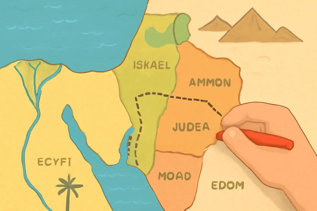
These maps trace the journeys described in the Bible—patriarchal treks, exoduses, exile routes, and missionary travels. They help children see how a story unfolds across geography and time. Expect to see routes drawn with bold lines, with key stops highlighted along the way. Some versions pair routes with brief notes about the people who traveled them, the challenges they faced, and the significance of each location.
Biblical geography overlays
In overlays, images of biblical scenes are layered onto modern basemaps. For example, a map might show the Sea of Galilee around a scene from Jesus’ ministry, or place the Garden of Eden in a stylistic, easily legible frame. This variation blends geography with storytelling, enabling discussions about where events took place and why geography mattered to the people in those stories.
Timeline and geography hybrids
Some maps integrate a chronological axis—years or eras—alongside geographic details. This helps learners connect events like Abraham’s call, the Exodus, and the life of Jesus with specific places and routes. The combination of timeline and place fosters both temporal thinking and spatial reasoning.
Fold-out and wall formats
To suit classrooms, homeschooling, and church settings, the formats include poster maps for wall display, fold-out booklets for take-home study, and pocket-sized handheld maps for guided activities. Each format preserves the essential features—legends, scale, and readable labels—while matching different use cases.
Digital Bible maps offer interactive experiences: tap a city to reveal a verse, click a route to hear a short narration, or drag a compass to practice direction. These interactive maps for kids can be especially engaging for screen-based learning, enabling self-paced exploration and immediate feedback through questions or prompts.
Regions and topics commonly covered
To support both literacy and curiosity, children’s Bible maps frequently spotlight key biblical regions and themes. While the exact content varies, most resources cover a core set of places and narratives that recur across the Bible. Here are focal areas you will typically encounter:
Genesis and the Garden: Maps may show the Garden of Eden, the rivers Gihon, Pishon, Havilah, and Euphrates, and the prehistoric world in which humanity’s early stories unfold.
Patriarchal journeys: The calls and travels of Abraham, Isaac, and Jacob often appear as routes through Mesopotamia, Canaan, Egypt, and beyond, highlighting promises and relationships with God.
Egypt and the Exodus: The Nile, Sinai Peninsula, Red Sea crossing, and wilderness wanderings are common features, with emphasis on the surrounding landscapes and the purposes of those journeys.
Israel and Judah: Maps mark major cities (Jerusalem, Bethlehem, Nazareth, Hebron), with boundaries of ancient kingdoms and the sites of significant events.
Jerusalem and the Holy Land: The Jerusalem area is often presented with its temples, valleys, and routes to illustrate religious themes and historical events.
New Testament geography: Jesus’ ministry around Galilee, Jerusalem, and surrounding regions, as well as the travels of Paul, appear on many kid-focused maps to connect gospel narratives with places.
Cultural and historical context: Some maps include notes about ancient trade routes, empires, languages, and archaeological finds to deepen understanding.
These regions and topics are not just about placing names on a map; they’re about weaving spatial understanding into the fabric of biblical faith. The best maps invite children to ask questions such as, “Why did God choose this place?” or “How did geography influence the story’s challenges and outcomes?”
Using Bible maps in learning activities
Maps come alive when paired with engaging activities. Here are practical ways to use children’s bible maps to reinforce learning, spark curiosity, and develop essential skills:
Story-to-map mapping: After reading a Bible story, have kids locate the places on a map and mark the route, then retell the story using the map as a guide.
Route tracing: Give children a blank map and ask them to draw the journey described in a passage, labeling key stops and explaining why each location mattered.
Timeline and geography: Combine a timeline with a corresponding map segment (e.g., the Exodus route and the 40 years in the wilderness) to link events to geography.
Memory scavenger hunts: Create clues that lead children to labels and landmarks on a map, reinforcing recall and map-reading skills.
Comparative maps: Use two maps showing different periods (e.g., the ancient boundaries of Israel and a modern political map) to discuss how places change over time and what remains meaningful in a biblical context.
Craft and kinesthetic activities: Use tactile map pieces or magnetic boards to place cities and routes, supporting hands-on learning for kinesthetic learners.
In addition to hands-on activities, educators can integrate reflection prompts such as “What does this place teach us about faith, courage, or trust?” or “How might the geography have affected the decisions characters made?” to deepen spiritual learning alongside geography.
Choosing the right map for your child or classroom
With a range of options available, selecting the best map for kids depends on the learner’s age, interests, and goals. Here are practical considerations to help you decide:
Age and reading level: Younger children benefit from bold labels, simple icons, and large symbols. Older kids can handle more detail, additional layers, and contextual notes.
Format and setting: For a classroom wall, a large poster with a clean legend works well. For home study, a fold-out map or a digital app with interactive questions can be more engaging.
Curriculum alignment: If your program emphasizes a particular narrative arc (e.g., the patriarchs, the life of Jesus), choose maps that highlight those routes and sites.
Accessibility: Audio narration, high-contrast labels, and tactile variants ensure inclusivity for children with different needs.
Durability: In busy classrooms or homeschool spaces, durable materials (laminated posters, magnetic boards) withstand repeated handling.
It can be helpful to combine several formats. For example, pair a wall map for in-class reference with a laminated mini-map for individual exploration during quiet time or family study. This multi-format approach maximizes exposure to Bible geography across contexts and reinforces learning through repetition and variety.
Resources and practical tips for families and educators
There are many sources for children’s bible maps, ranging from publishers specializing in religious education to general children’s atlases that incorporate biblical geography. Here are some practical tips to find and use reliable resources:
Check age-appropriate labeling: Look for maps designed for children, with clear fonts, big labels, and minimal overload of information.
Look for narrative connections: Maps that explicitly link locations to Bible stories tend to be more engaging for kids than purely technical maps.
Consider a blended approach: Use both traditional paper maps and digital options to accommodate different learning styles and accessibility needs.
Utilize teacher guides and prompts: Many map sets include discussion questions, suggested activities, and vocabulary lists that support educators and parents.
Involve kids in the process: Invite children to annotate maps, create their own routes, or illustrate the landscapes they read about. Ownership fosters motivation and curiosity.
When selecting resources, you may encounter terms like Bible atlas for kids, biblical geography posters, or interactive Bible maps. Although the formats vary, each aims to build a foundation of geographic literacy anchored in spiritual narratives. Families and educators can curate a small collection that includes a durable map for shared viewing plus one or two interactive or hands-on options for individual exploration.
Practical examples of how to use map resources in the Bible study routine
To illustrate how children’s Bible maps fit into daily or weekly routines, here are practical examples you can adapt to family devotions, Sunday school, or homeschool schedules:
Weekly geography spotlight: Each week, focus on a different region or journey. Read a related Bible passage, then locate the places on the map and discuss how geography influenced the story.
Creation to Covenant sequence: Begin with a broad map of the ancient world, then narrow the focus to the Fertile Crescent and the land of Canaan as the narratives unfold.
Character journey posters: Create a character-centric map that traces where a person traveled—e.g., Abraham’s journeys or Paul’s missionary routes—and pair it with a short biography.
Church or classroom display: Install a large wall map with removable labels or magnets so students can re-create journeys during lessons, reinforcing retention through active participation.
Testing geographic skills: Use a map-based quiz or scavenger hunt where children locate places from memory, then verify on the map and summarize the passage connected to each location.
These activities not only teach geography but also cultivate critical thinking, narrative comprehension, and spiritual reflection. The combination helps children see that the biblical world was as real in space as it is meaningful in faith.
Conclusion: Nurturing a lifelong map literacy through children’s Bible maps
Children’s Bible maps are more than decorative educational aids. They are tools that transform abstract place names into a tangible geography—one that children can explore, discuss, and revisit as they grow in knowledge and faith. By choosing maps with clear legends, appropriate complexity, and story-centered design—and by using them in a variety of hands-on activities—you provide a foundation for map literacy and biblical understanding that can last a lifetime.
Whether you prefer traditional paper maps, interactive digital maps, or a combination of formats, the goal remains the same: help children see the Bible as a journey through real places. When a child points to a map and says, “I know where that is,” you’ve already helped them integrate geography with faith, imagination with memory, and curiosity with study. That is the heart of effective, engaging, and enduring Bible education for kids.



Leave a Reply