If you search for the Ur of Chaldees location, you will usually find a place name that sounds biblical but is difficult to locate on a modern map. The site generally identified as Ur of the Chaldees is Tell el-Muqayyar, an ancient city in southern Iraq near the modern city of Nasiriyah.
Tell el-Muqayyar lies in Dhi Qar Governorate, within the broad region of ancient Mesopotamia between the Tigris and Euphrates rivers. The archaeological ruins include the famous Great Ziggurat of Ur, temple remains, residential areas, tombs, and evidence of a major urban center that flourished thousands of years ago.
Short answer: Most archaeologists identify biblical Ur with Tell el-Muqayyar, about 10 miles, or 16 kilometers, west of Nasiriyah in southern Iraq. The name “of the Chaldees” creates a historical dating question because the Chaldeans became prominent in the region much later than Ur’s earliest periods.
Where is Tell el-Muqayyar, the site identified with Ur?
Tell el-Muqayyar is located in southern Iraq, in the historic landscape once known as Sumer. It is near Nasiriyah, a regional city situated along the Euphrates system, and is roughly south of Baghdad. The site is not within the modern city itself; it is an archaeological mound surrounded by the flat, dry plains of southern Mesopotamia.
The Arabic name Tell el-Muqayyar means “the mound of pitch” or “the mound of bitumen.” The name reflects the dark appearance of the mound’s layers and the use of bitumen, a naturally occurring asphalt-like substance, in ancient construction. Archaeological tells form when people build, rebuild, abandon, and rebuild settlements over many generations.
Modern maps may display the site as Ur Archaeological Site, Tell el-Muqayyar, or simply Ur. These names refer to the same general ruins. If you are looking for directions, searching for “Ur archaeological site near Nasiriyah” is usually more useful than searching only for “Ur of the Chaldees,” which is primarily a biblical expression rather than a modern administrative name.
Ancient Ur once stood closer to the Euphrates than it does today. The river’s course changed over time, while irrigation, sediment, and environmental shifts altered the surrounding landscape. The site that now appears isolated in an arid plain was once part of a populated riverine region connected to canals, fields, marshes, trade routes, and the Persian Gulf.
Why Tell el-Muqayyar is identified as the biblical Ur
The identification rests on several lines of evidence rather than one single discovery. Ancient texts connect the name Ur with a major Sumerian city, and inscriptions found at Tell el-Muqayyar identify the settlement as Urim, the Sumerian form of Ur. The city was a prominent political and religious center, making it a plausible candidate for the biblical place name.
The Hebrew Bible refers to Abraham’s ancestral home as “Ur of the Chaldees”, especially in Genesis and later genealogical passages. The biblical wording distinguishes this Ur from other places that may have shared the name. In common Christian, Jewish, and Muslim discussions, the site in southern Iraq has therefore become the standard geographical identification.
The ruins also match the image of an important ancient city. Ur was not a small village that happened to survive in a text. It had monumental temples, organized neighborhoods, administrative buildings, craft production, and a long history of regional influence. Its remains show why a later writer or community could refer to it as a notable ancestral homeland.
The identification is widely accepted, but it is not proven in the sense of an inscription that says, “This is Abraham’s city.” Archaeology can identify ancient Ur as a real place and reconstruct its history. It cannot independently verify every person or event described in a biblical narrative, especially when the relevant historical period is uncertain.
What “of the Chaldees” means for the location
The phrase “of the Chaldees” causes a chronological problem. The Chaldeans were a people associated with southern Mesopotamia who became prominent many centuries after the earliest great periods of Ur. The Chaldean kingdom later ruled Babylonia, particularly during the first millennium BCE.
Ur itself reached major peaks long before the Chaldean dynasty. It was especially important during the Third Dynasty of Ur, often dated to the late third millennium BCE, and it remained significant in later periods. The label “of the Chaldees” may reflect a later way of identifying the area for an audience familiar with the Chaldeans, rather than a claim that Chaldeans founded or controlled Ur during Abraham’s lifetime.
Some readers interpret the phrase as evidence that the biblical text was written or edited at a later time, when the Chaldeans were a recognizable group in southern Mesopotamia. Others have proposed that the name preserves an older tradition or that “Chaldees” was attached to distinguish this Ur from another location. These explanations concern the history of the text and its geographical terminology, not the physical position of Tell el-Muqayyar.
The phrase also explains why a simple search can produce conflicting answers. Someone may ask where the city was, while another source discusses when the term “Chaldees” became common. The strongest general answer remains that Ur was in southern Mesopotamia at Tell el-Muqayyar, while the wording “of the Chaldees” requires historical interpretation.
What the ancient city of Ur was like
Ur began as an important settlement in the southern Mesopotamian world and developed into a large urban center. Its fortunes changed across the centuries, but the city repeatedly benefited from its location near river routes and the Gulf. Water supported agriculture, transportation, and trade, although it also required constant management through canals and embankments.
The city was closely associated with Nanna, the Sumerian moon god, who was also known by the Akkadian name Sin. The great temple complex dedicated to Nanna dominated the city’s religious landscape. The ziggurat was not a tomb or a pyramid; it was a stepped temple platform that raised the sacred precinct above the surrounding city.
Ancient Ur also contained royal and administrative buildings. Excavations uncovered thousands of clay tablets and other objects that reveal taxation, labor, grain distribution, land management, trade, and religious activity. These records show a society organized through institutions rather than a settlement known only for a single monument.
Residential areas provide a different view of Ur. Houses were often built around central courtyards, with rooms arranged for household, storage, craft, and administrative purposes. Streets, drains, ovens, tools, pottery, and personal objects help archaeologists reconstruct ordinary routines alongside the activities of kings and priests.
Ur’s burial grounds are also famous. The Royal Cemetery of Ur contained richly furnished graves from the early dynastic period, including jewelry, vessels, musical instruments, weapons, and other objects. These finds demonstrate the wealth and social hierarchy of an early Mesopotamian elite, although they should not be treated as direct evidence about Abraham or the biblical family narratives.
How the Great Ziggurat helps visitors recognize Ur
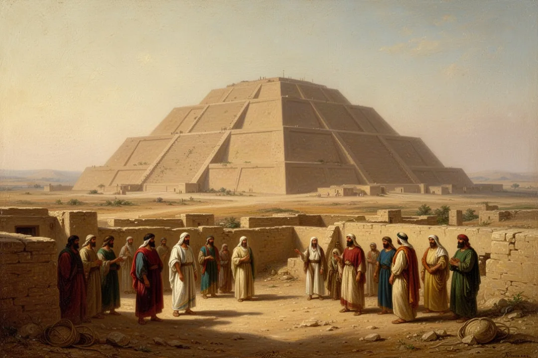
The Great Ziggurat is the most recognizable structure at the site. Its lower levels remain visible as a large, solid platform made from mudbrick and reinforced with baked brick and bitumen in parts of the construction. The monument was repeatedly repaired and rebuilt, so its surviving form reflects several ancient periods rather than one uninterrupted building phase.
King Ur-Nammu, founder of the Third Dynasty of Ur, is strongly associated with the ziggurat’s construction. Later rulers restored or modified parts of the religious complex. The building was dedicated to Nanna and served as the elevated base of a temple, not as a place where worshippers climbed to meet a deity in the way a modern visitor might imagine.
At ground level, the ziggurat can look less like a towering pyramid than photographs suggest. Erosion, missing upper stages, restricted areas, and the broad scale of the surrounding plain affect how it appears. Even so, its massive stairways and brickwork make it easy to identify as the central landmark of the archaeological site.
The ziggurat should also be viewed as part of a larger urban setting. Focusing only on the monument can obscure the city’s neighborhoods, temples, cemeteries, and administrative spaces. Ur’s importance comes from the relationship between these elements: religion, government, households, trade, agriculture, and burial practices operated within one complex urban environment.
What archaeologists discovered at Ur
Modern archaeological work at Ur began in the nineteenth century and became especially extensive during excavations led by Leonard Woolley in the twentieth century. The work exposed monumental architecture, royal tombs, inscriptions, domestic buildings, and large collections of artifacts. Excavations and later research have continued to shape understanding of the site.
Woolley’s discoveries brought global attention to the Royal Cemetery. Some graves contained extraordinary quantities of precious materials and carefully made objects. The finds included gold ornaments, carved stone, decorated vessels, weapons, and musical instruments. They offer evidence for long-distance exchange and highly developed craftsmanship in early Mesopotamia.
Clay tablets are equally significant, even though they attract less visual attention. Written in cuneiform, they record the practical workings of institutions: deliveries, rations, contracts, property, legal matters, and religious administration. Such documents help historians understand how Ur functioned day by day.
Archaeology at Ur also raises ethical questions. Early excavations divided finds between Iraq and foreign institutions under the rules and practices of their time, while modern archaeology places greater emphasis on national heritage, documentation, conservation, and collaboration. Objects from Ur are now held in museums and collections in Iraq and elsewhere, but their origins remain tied to the Iraqi site.
Keep the evidence in proportion: The ruins confirm the existence and importance of ancient Ur. They do not provide direct archaeological proof that Abraham lived there. A careful explanation separates what the site demonstrates from what religious tradition or later interpretation associates with it.
How Ur fits into the history of southern Mesopotamia
Ur’s history stretches across several thousand years, and its appearance changed repeatedly. The city was part of the Sumerian civilization that developed in southern Mesopotamia, where irrigation agriculture supported dense settlements and early urban institutions. Sumerian cities competed, traded, formed alliances, and fought for influence.
During the Third Dynasty of Ur, the city became the center of a powerful state. Royal administration extended across a substantial territory, and officials managed labor, resources, construction, taxation, and religious institutions. This period produced an unusually rich written record, allowing historians to study government at a detailed level.
After the fall of the Third Dynasty, Ur remained an important city under later rulers. Its religious identity continued even as political control shifted. Babylonians, Kassites, and other powers influenced the region at different times, and the city’s importance gradually declined as economic conditions, river courses, and political centers changed.
By the time classical writers described Mesopotamia, much of the old city had already fallen into ruin or been covered by accumulated debris. The desert-like setting seen by modern visitors is therefore the end result of environmental change and abandonment, not a picture of Ur during its period of greatest prosperity.
How far Ur was from the ancient coast
Ur is often described as a city near the Persian Gulf, but the phrase needs context. The coastline was probably farther inland in parts of antiquity than it is today, because the Tigris and Euphrates carried sediment into the Gulf. Over centuries, those deposits changed the shape of the delta and the distance between settlements and open water.
Ur’s position gave it access to waterways leading toward the Gulf and to trade connections beyond southern Mesopotamia. Materials found in the city point to exchange with regions that did not naturally produce all of the stone, metals, timber, and luxury goods used by its inhabitants.
The landscape also depended on canals. Ancient farmers did not simply rely on rainfall, which is limited in southern Iraq. They maintained irrigation networks that brought river water to fields, while administrators organized labor and distributed agricultural products. When canal systems deteriorated or river patterns shifted, the city’s economic position could suffer.
Alternative proposed locations for Ur of the Chaldees
Tell el-Muqayyar is the dominant identification, but it has not been the only proposal. Some scholars and interpreters have suggested locations in northern Mesopotamia or southeastern Anatolia, partly because of attempts to connect the biblical travel narrative with a route through Harran and the upper Euphrates region.
Other proposals depend on linguistic arguments, differing readings of ancient place names, or the idea that the biblical “Ur” might refer to a place other than the famous Sumerian city. These theories vary considerably in evidence and acceptance. Most archaeological reference works still identify Ur with Tell el-Muqayyar.
One reason alternative theories continue to appear is that the Bible does not provide modern coordinates. The narrative describes movement between places and regions using ancient geographical terms. Those terms can change meaning over time, and routes may follow landscapes that no longer exist because rivers, marshes, roads, and political borders have shifted.
When comparing locations, ask whether a proposal has support from ancient inscriptions, archaeological remains, historical geography, and linguistic evidence. A theory based only on a similar-sounding modern name is much weaker than one supported by multiple independent lines of evidence.
Practical tips and common mistakes when researching Ur’s location
Online maps, Bible study resources, and archaeological references do not always use the same terminology. These steps can help you check information without confusing the ancient city with the biblical phrase or with other places named Ur.
Search for Tell el-Muqayyar and Nasiriyah together. This usually produces more precise modern location information than searching only for Ur of the Chaldees.
Distinguish ancient Ur from modern Iraq. Ur was a city in Sumer and later Mesopotamian political worlds; it was not located in a modern country during its own history.
Check whether a source means the archaeological site or the biblical tradition. A religious source may discuss Abraham, while an archaeological source may focus on the ziggurat and cuneiform tablets.
Do not treat the ziggurat as Abraham’s house. It was a monumental religious structure associated with Nanna, not evidence of a specific family residence.
Remember that “Chaldees” is a later historical label. The label does not mean the Chaldeans ruled Ur during every period of the city’s existence.
Look for uncertainty where the evidence is uncertain. “Generally identified with” is more accurate than claiming that archaeology has proved every detail of the biblical account.
Use current travel guidance before planning a visit. Conditions, permissions, opening arrangements, and security circumstances can change, so old travel pages may not be reliable.
A common mistake is placing Ur in northern Iraq because Abraham’s journey is often discussed alongside Harran. Harran was another important ancient center, but it is not the same place as Ur. The biblical story can connect several locations without placing them all in the same region.
Another mistake is assuming that the modern Iraqi site must look like a preserved city. Much of Ur survives as foundations, platforms, brickwork, graves, and mounds. The missing upper structures and altered landscape make historical reconstruction necessary.
What you can see at the Ur archaeological site
Visitors who reach the site may see the Great Ziggurat, the remains of temple complexes, parts of ancient buildings, and areas associated with the Royal Cemetery. The exact accessibility of individual structures depends on conservation work, local management, security, and current visitor arrangements.
The ziggurat is usually the first feature people recognize, but the surrounding remains deserve attention. Look for the relationship between elevated religious architecture and lower urban spaces. The city’s organization reflects how sacred institutions, royal authority, administration, and household life were connected.
Interpretation can be difficult because the site is broad and the ruins are exposed. A knowledgeable guide, museum material, or reliable archaeological plan can help you understand what is visible. Without context, a low wall may look insignificant even though it represents a house, administrative room, street boundary, or later rebuilding phase.
Travelers should also treat the ruins as a protected cultural site. Do not climb restricted structures, remove pottery fragments, walk across fragile brickwork, or photograph people without permission. Weather can be severe, and there may be little shade or visitor infrastructure, so practical preparation matters.
Why the location still matters
The location of Ur matters for more than identifying a biblical place name. It connects the biblical world with the archaeological record of one of the earliest urban civilizations. At Tell el-Muqayyar, questions about religion, kingship, writing, trade, irrigation, social inequality, and environmental change become visible in one landscape.
Ur also illustrates how place names accumulate layers of meaning. Urim refers to the ancient city in Sumerian records. Ur of the Chaldees is the biblical designation. Tell el-Muqayyar is the modern Arabic name for the archaeological mound. Each name reflects a different period and viewpoint.
The most responsible answer is therefore both clear and qualified: the site traditionally and commonly identified as Ur of the Chaldees is Tell el-Muqayyar in southern Iraq, near Nasiriyah. The archaeological city is securely located, while the connection between that city and the biblical patriarchal narrative remains a matter of historical and religious interpretation.
How to describe Ur of the Chaldees accurately
For a school assignment, Bible study, travel plan, or general explanation, a precise description can be brief: Ur of the Chaldees is generally identified with the ancient Sumerian city of Ur at Tell el-Muqayyar in southern Iraq, near Nasiriyah. You can then add that the site is famous for its Great Ziggurat and royal cemetery.
If the subject involves Abraham, use language that distinguishes tradition from direct evidence. Say that the biblical text presents Ur as Abraham’s ancestral home and that Tell el-Muqayyar is the widely accepted archaeological identification. Avoid saying that an excavation found Abraham’s personal belongings or proved the journey described in Genesis.
If the subject involves the Chaldeans, explain that the term belongs to a later historical context than Ur’s earliest and most famous periods. That distinction prevents the common error of treating all of ancient Mesopotamian history as one unchanged culture.
The location is firmly anchored in southern Iraq, but its meaning reaches across several kinds of evidence: biblical geography, Sumerian inscriptions, later Mesopotamian history, archaeological remains, and modern heritage work. Keeping those categories separate produces a clearer and more accurate picture of Ur.
Frequently asked questions
Is Ur of the Chaldees in modern Iraq?
Yes. The location most commonly identified as Ur of the Chaldees is Tell el-Muqayyar in southern Iraq. It is in Dhi Qar Governorate, near the modern city of Nasiriyah. The ancient city stood in the southern Mesopotamian region known as Sumer, although the modern national borders of Iraq did not exist during Ur’s ancient history.
How far is Ur from Nasiriyah?
Tell el-Muqayyar is approximately 10 miles, or 16 kilometers, west of Nasiriyah. Exact travel distance can vary depending on the route and access conditions. Search references may list the ancient site under Tell el-Muqayyar, Ur Archaeological Site, or Ur, so checking more than one name can help when using maps.
Did Abraham definitely live at Tell el-Muqayyar?
Archaeology confirms that Tell el-Muqayyar was the major ancient city of Ur, but it does not directly prove that Abraham lived there. The biblical tradition identifies Abraham’s origin with Ur of the Chaldees, and most scholars connect that name with Tell el-Muqayyar. The personal and historical details of Abraham’s life remain matters of interpretation.
Can tourists visit the ruins of Ur?
Visits have been possible, but access can depend on current security conditions, local permissions, conservation work, and site management. Travelers should check current Iraqi travel advisories and arrangements before going. The exposed site can also be hot and lacking in shade, so visitors should plan for weather, water, respectful behavior, and protection of fragile remains.








Leave a Reply